Woodland at Bredhurst - Sold

Details for this wood
Guide price: £15,000 - Freehold
Size: Just over 1 acre
Location: Hurstwood Road, Bredhurst, Kent
OS Landranger: 178
Grid ref: TQ 79979 61541
Nearest post code: ME7 3JZ
Contact: Ben Williamson
Phone: 07958 213 914
Email: [email protected]
Email to a friend
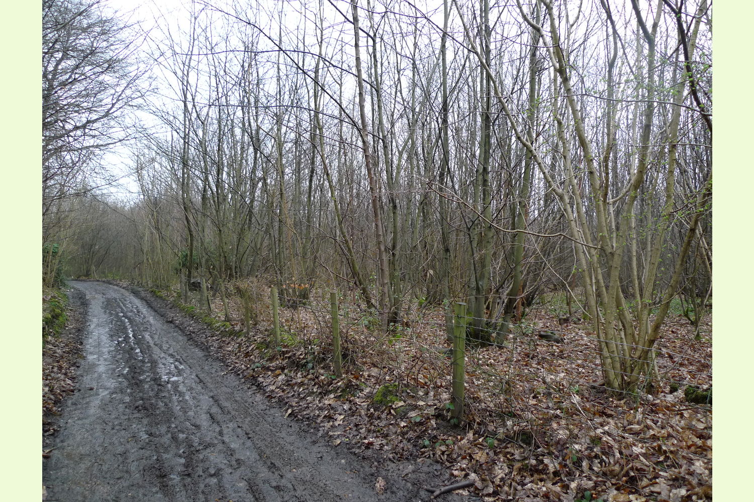
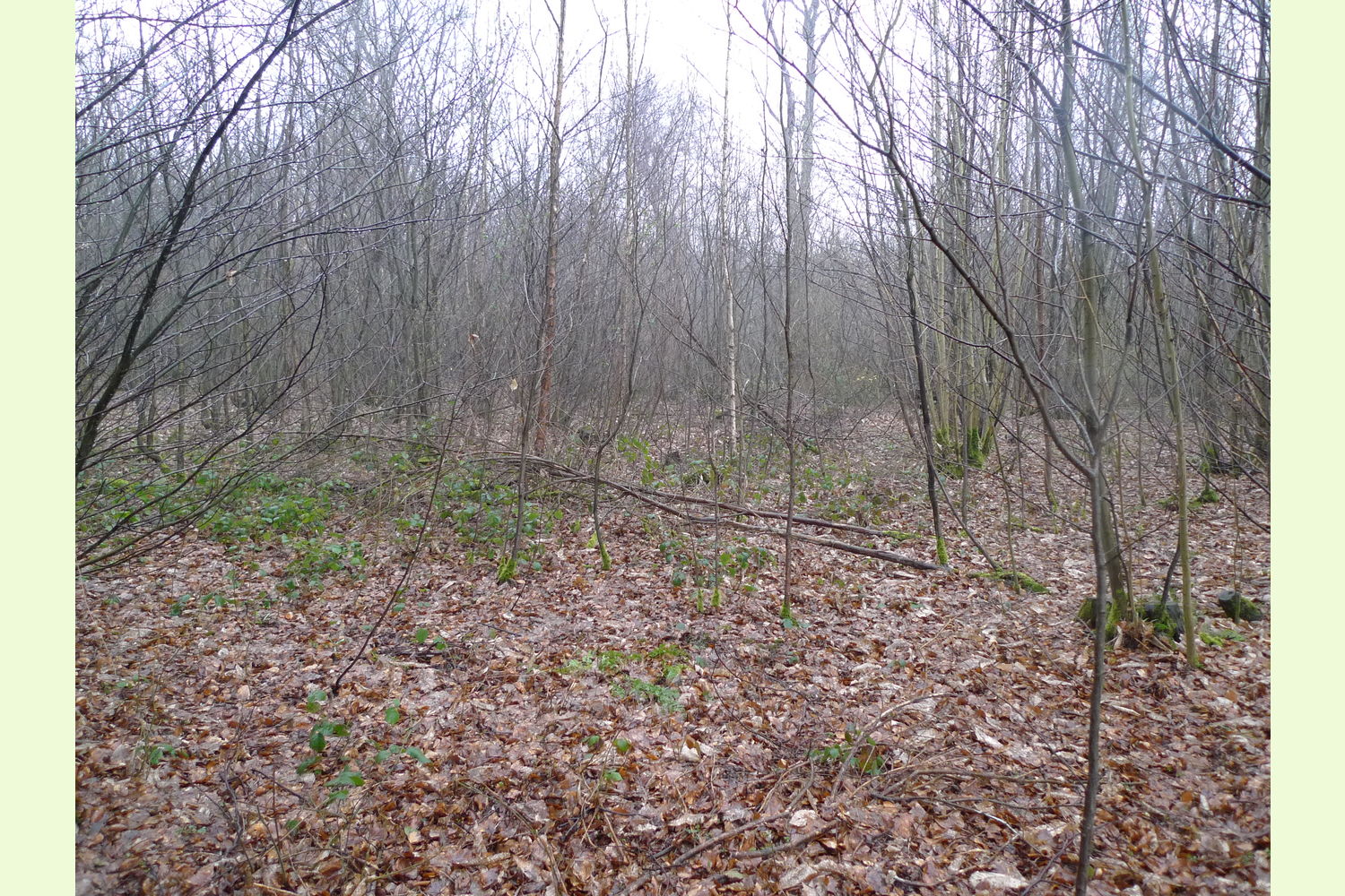
A small area of oak and chestnut woodland within the larger Bredhust woodlands. Designated as semi-narual ancient woodland and is located in the Kent Downs AONB (area of oustanding natural beauty) click here for details.
Bredhurst Wood is in multiple ownership and it would be well worth-while making contact with the goup below. The whole woodland is looked after by a very passionate group of conservationists who can be contacted through the website they maintain, https://bwag.org.uk/.
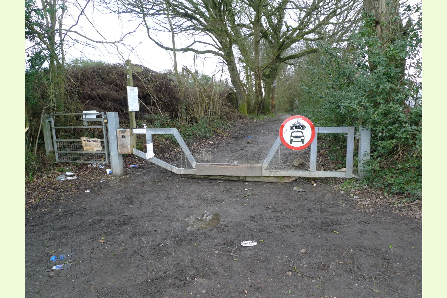
Access is off Hurstwood Road and then along a private track (also Hurstwood Road) where there is a right of way for vehicles. A new owner will be given the combination number to the gate.
Boundaries are unmarked
Full-scale Click here to download and print a map showing the location of the woodland.
Viewing: You are welcome to visit this wood by yourself, but please ensure that you have a copy of these sales details with you - many of our woodlands do not have mobile phone reception or internet access so we recommend either printing the details or downloading them to your phone or tablet. Please take care when viewing as the great outdoors can contain unexpected hazards and woodlands are no exception.
If unsure about viewing the wood during lockdown please ask for our viewer's guide.
Maps are : © Crown copyright and database rights 2021 OS Licence no.100057987
Our Maps (Click on a map to see a large version)
Our Maps
Directions
The wood lies just south of Bredhurst in Kent.
Click here for Bing Maps Directions enter your own postcode, (the coordinates for Hurstwood Road are already enetered). There should be space to park here at the roadside.
The track to the wood is only open for vehicles to wood owners but for viewing walk down this track
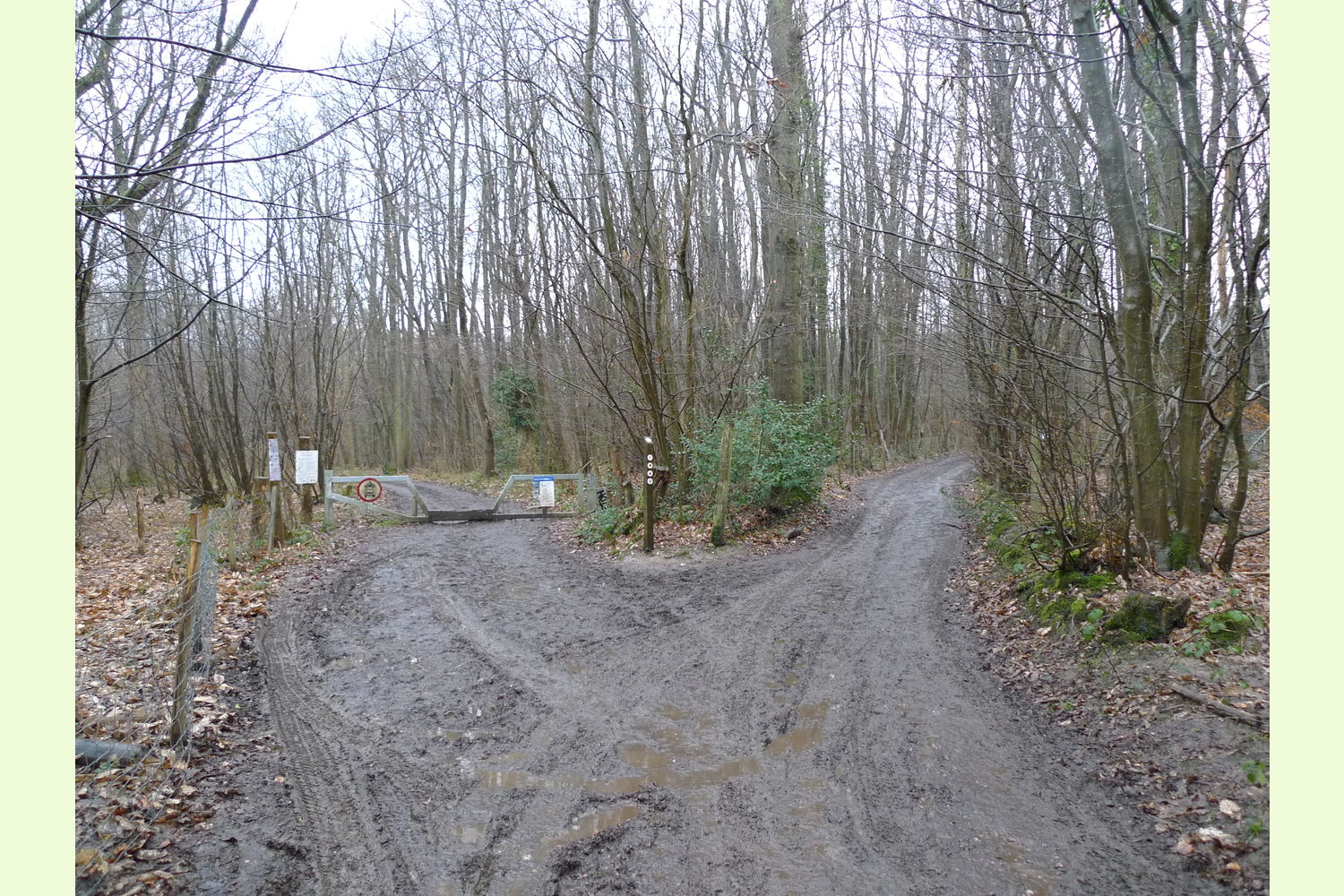
At the end of Hurstwood Road on the right is the access track, with a bridelway gate. The new owner will have the combination number for the gate. The track to the wood is through this gate turns left, then right, then sharp right by the buildings then ascends with the woodland for sale on the right.
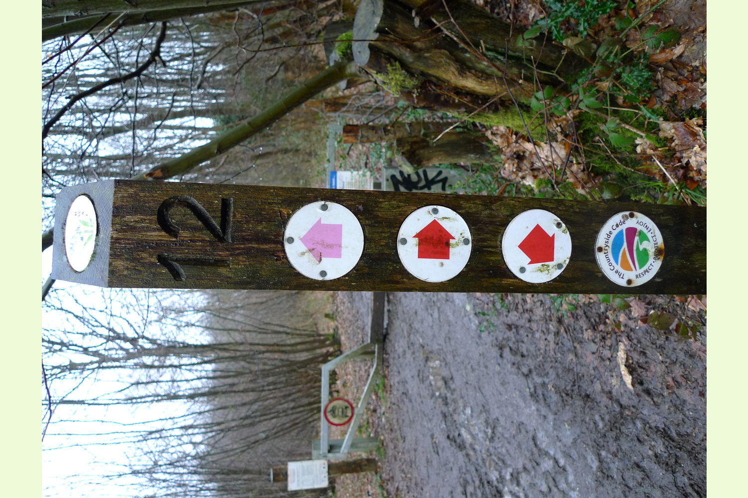
Walk as far as post 12 and the barrier (see photo) the wood for sale is about 50 metres back. See plans.
For Satnav: the nearest postcode is ME7 3JZ as shown by the red dot on the maps.
Coordinates for your satnav are N51.330544, E0.578396
www.bing.com/maps?v=2&sty=s&lvl=15&cp=51.330544%7E0.578396&where1=51.330544%2C0.578396
Please note: the particulars with plans, maps, descriptions and measurements are for reference only and although carefully checked we cannot guarantee their accuracy and do not form part of any contract. Any intending purchasers must satisfy themselves by inspection or otherwise as to the correctness of these particulars.