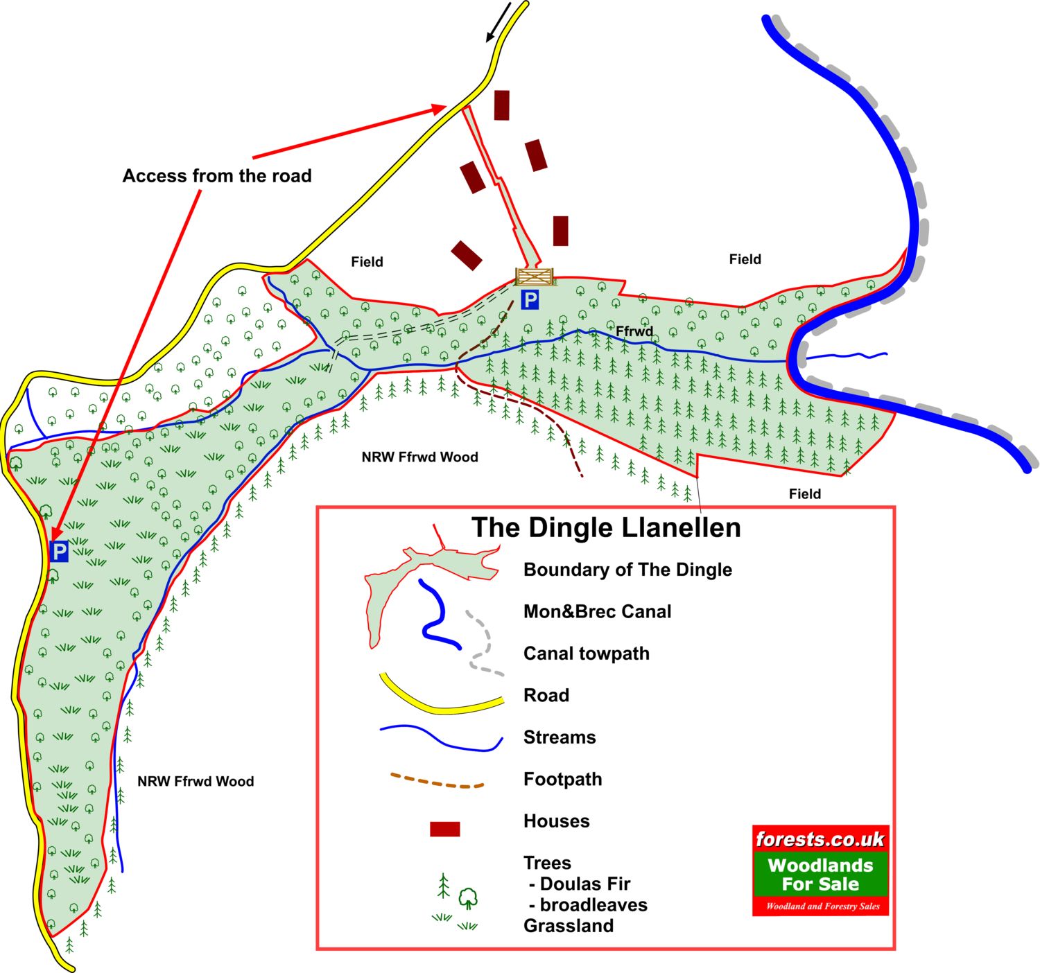
The Dingle, Llanellen

Details for this wood
Guide price: £275,000 - Freehold
Size: Almost 20½ acres
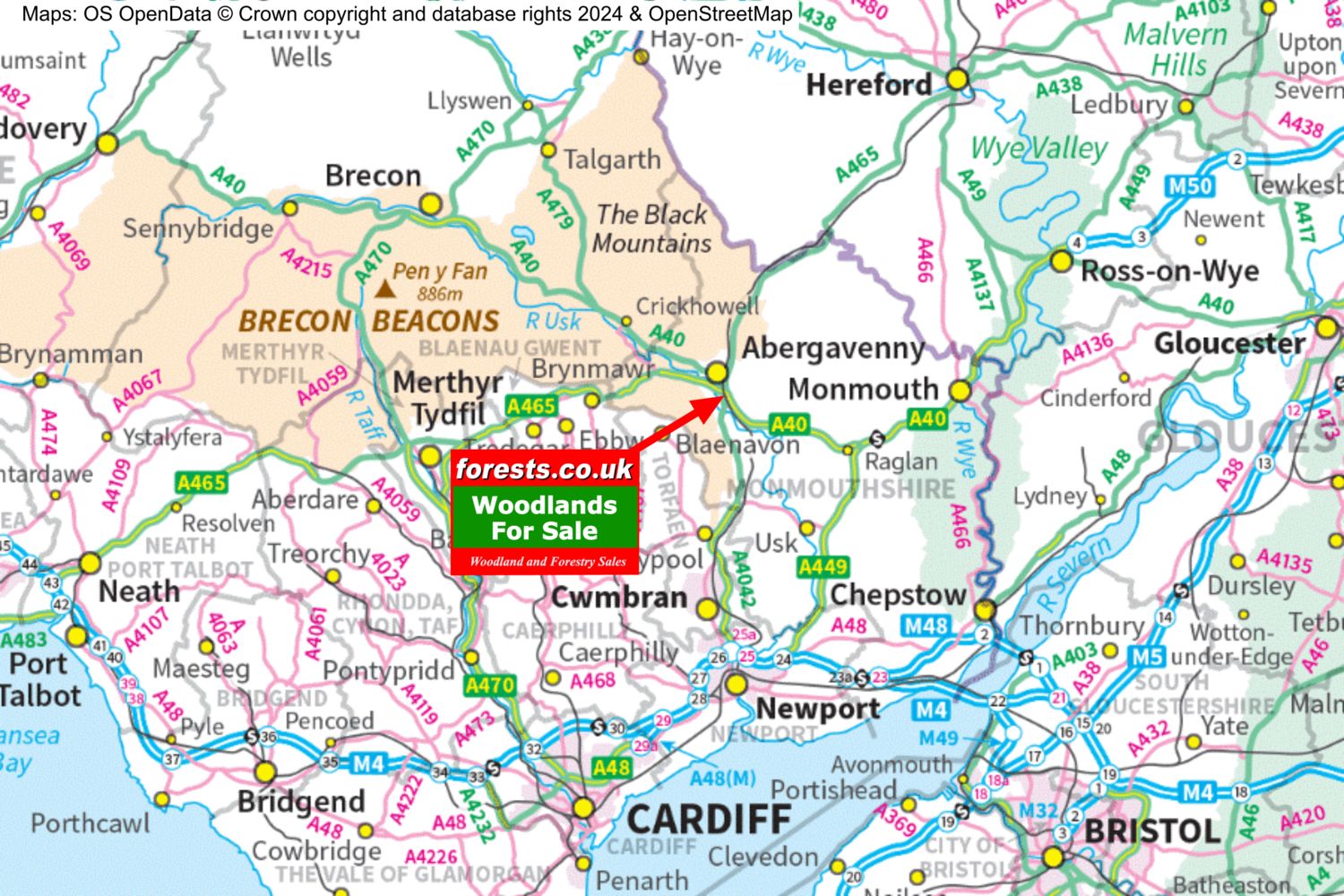
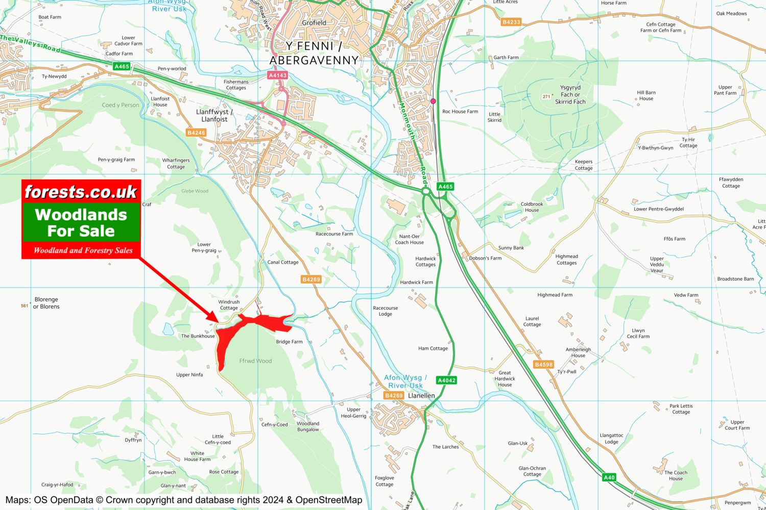
Location: Llanellen, Abergavenny, Monmouthshire
OS Landranger: 161
Grid ref: SO286115
Nearest post code: NP7 9LE
Contact: Sandra Colley
Phone: 07769654392
Email: [email protected]
Email to a friend
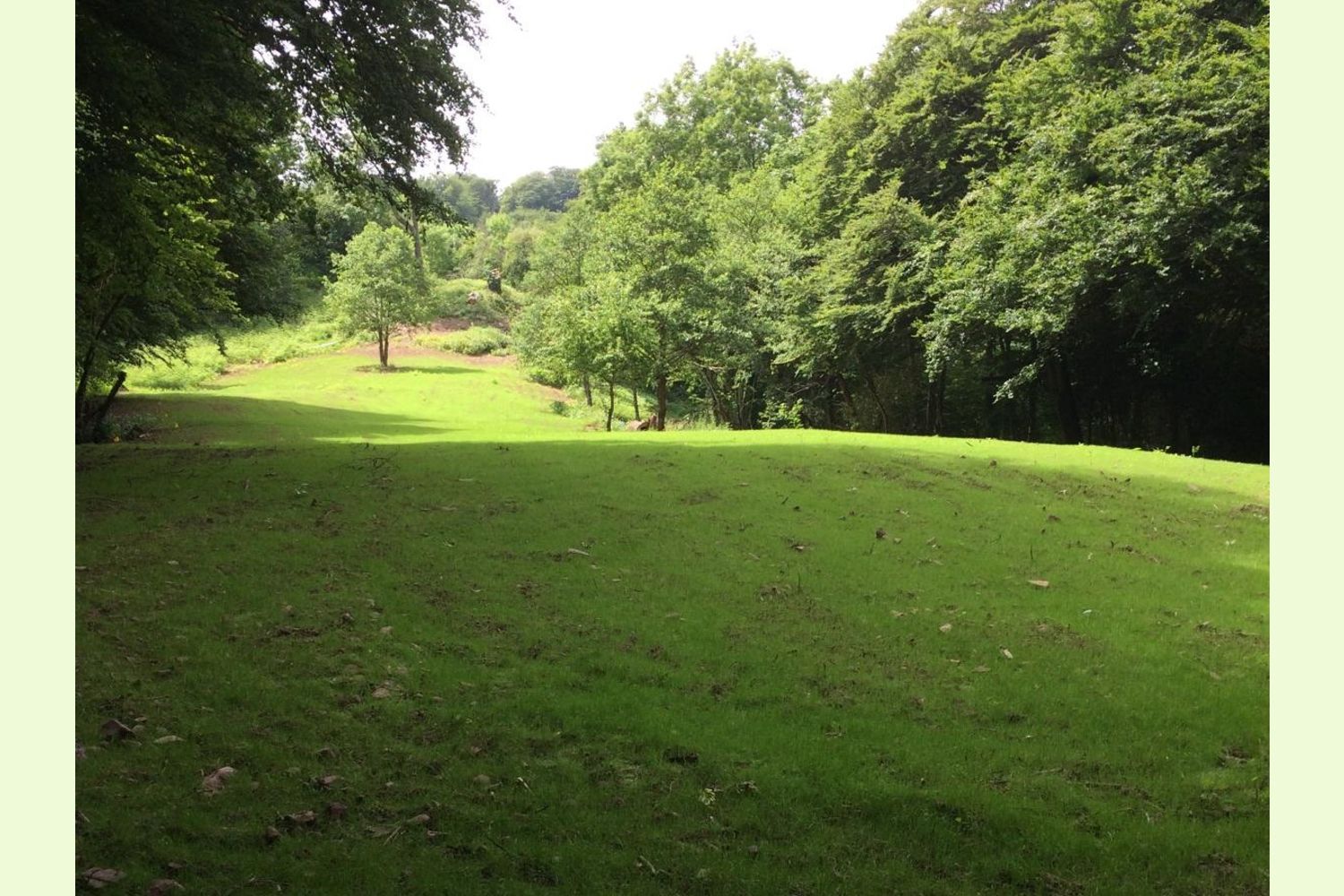
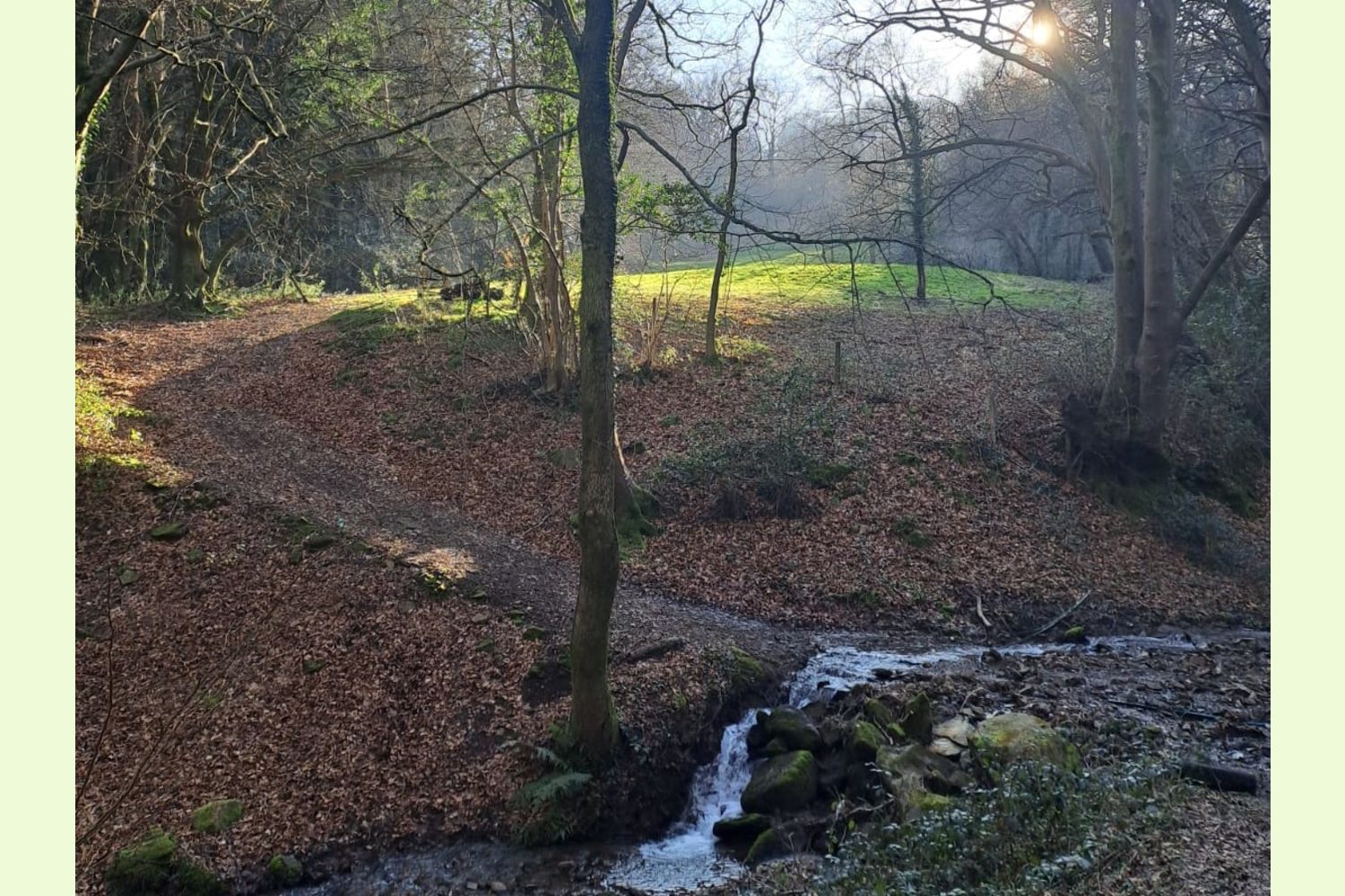
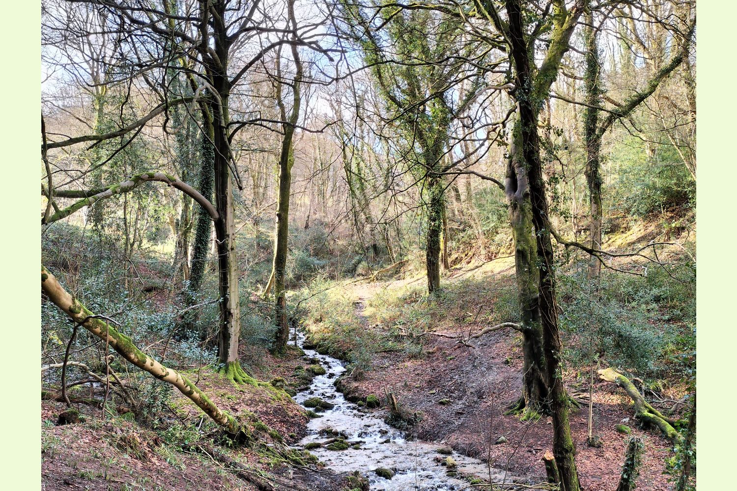
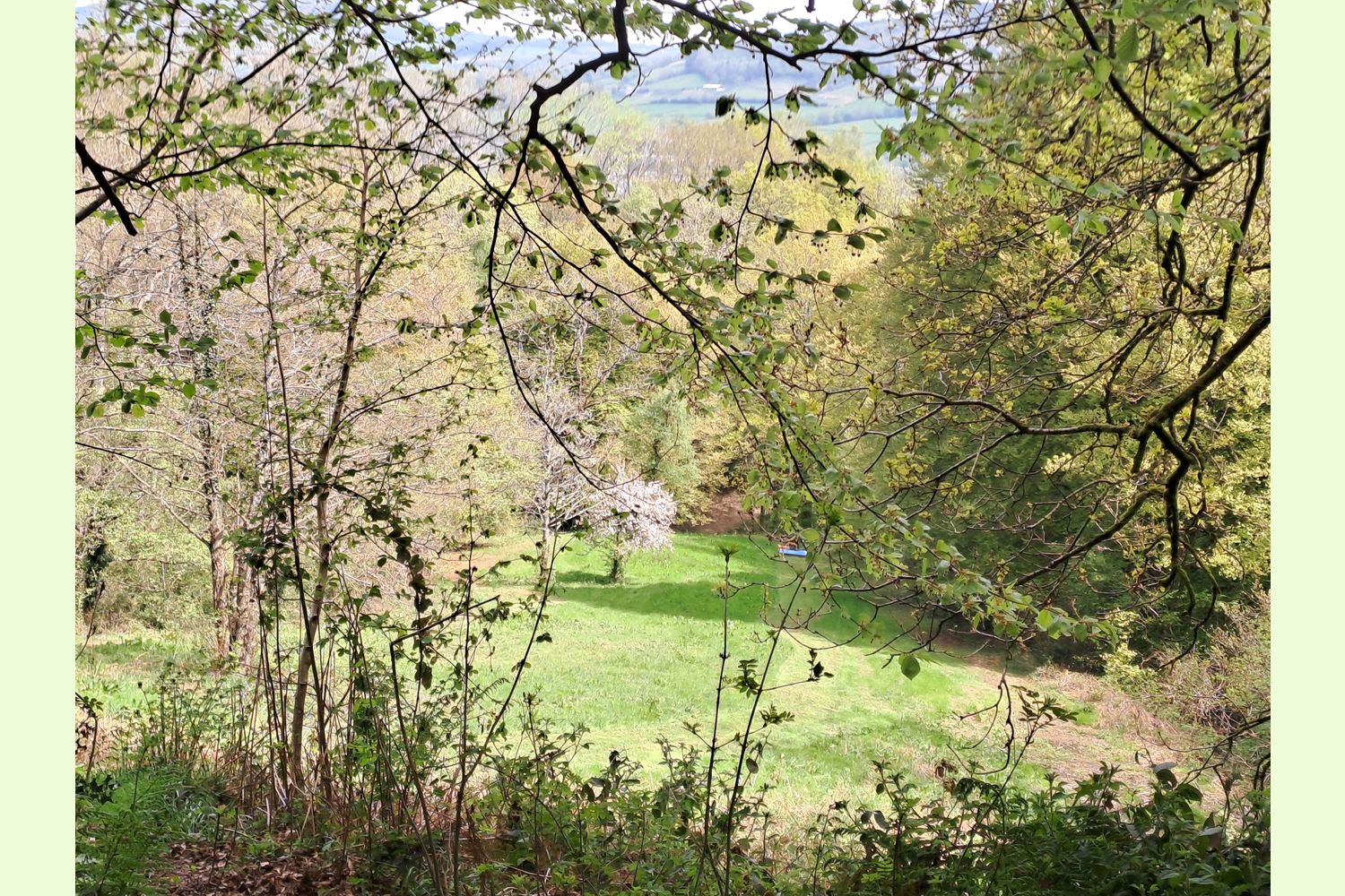
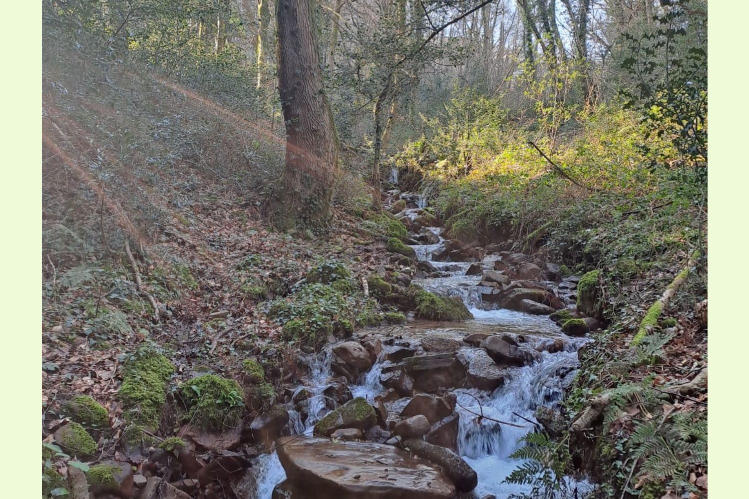
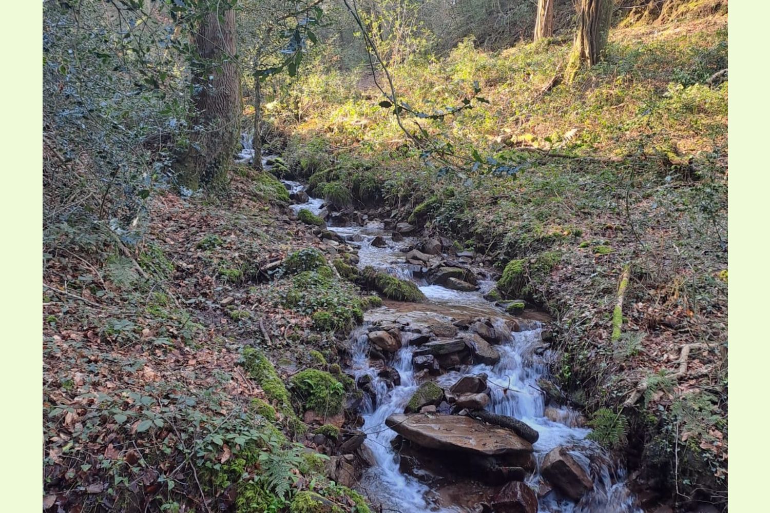
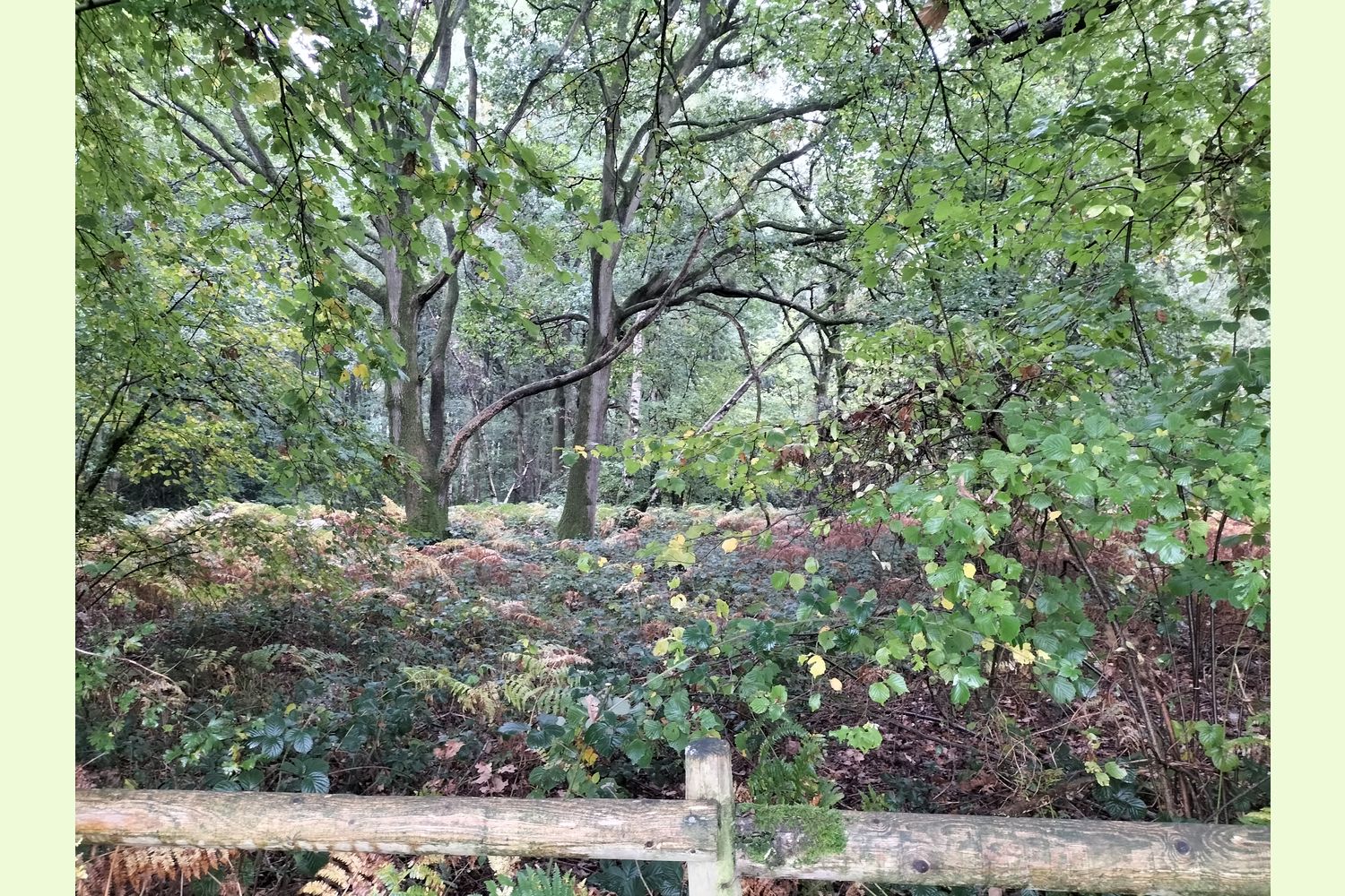
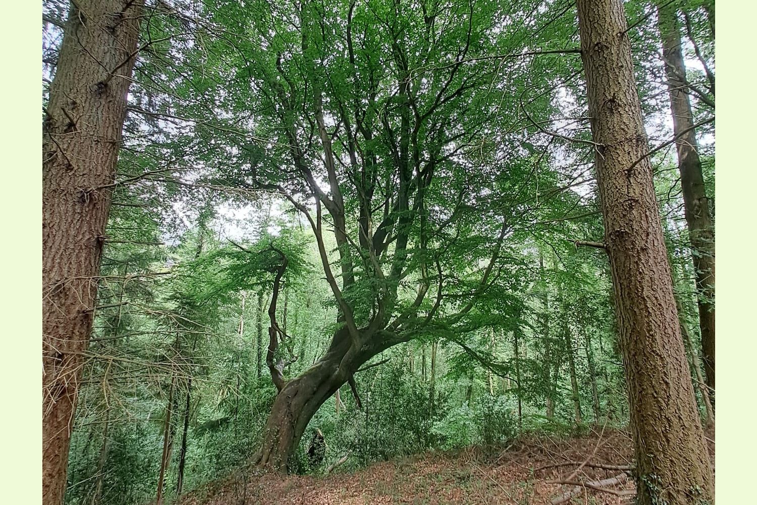
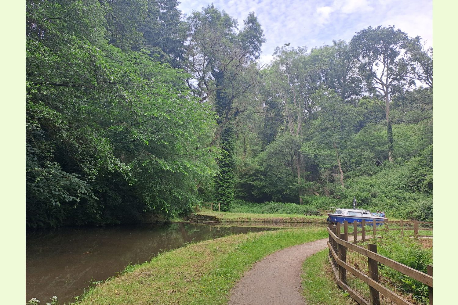
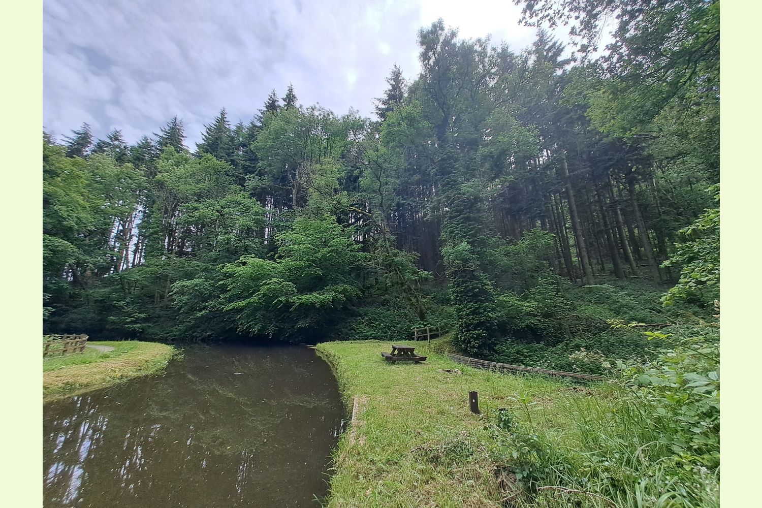
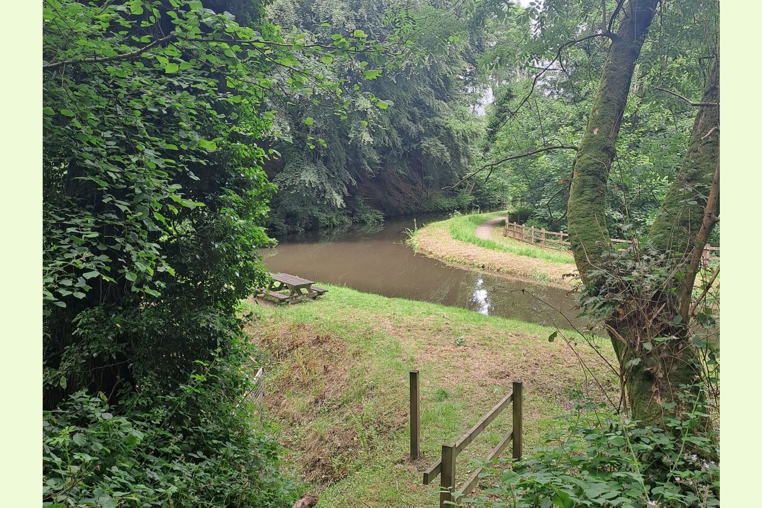
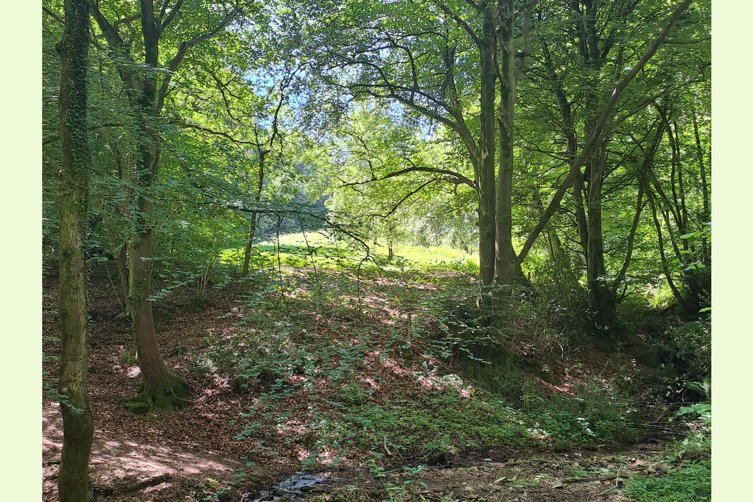
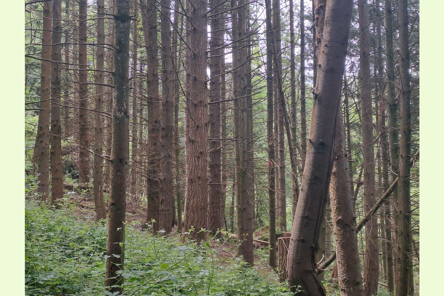
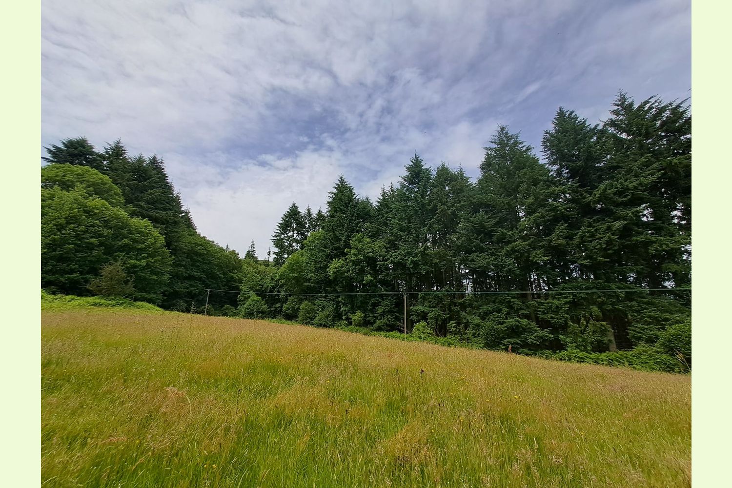
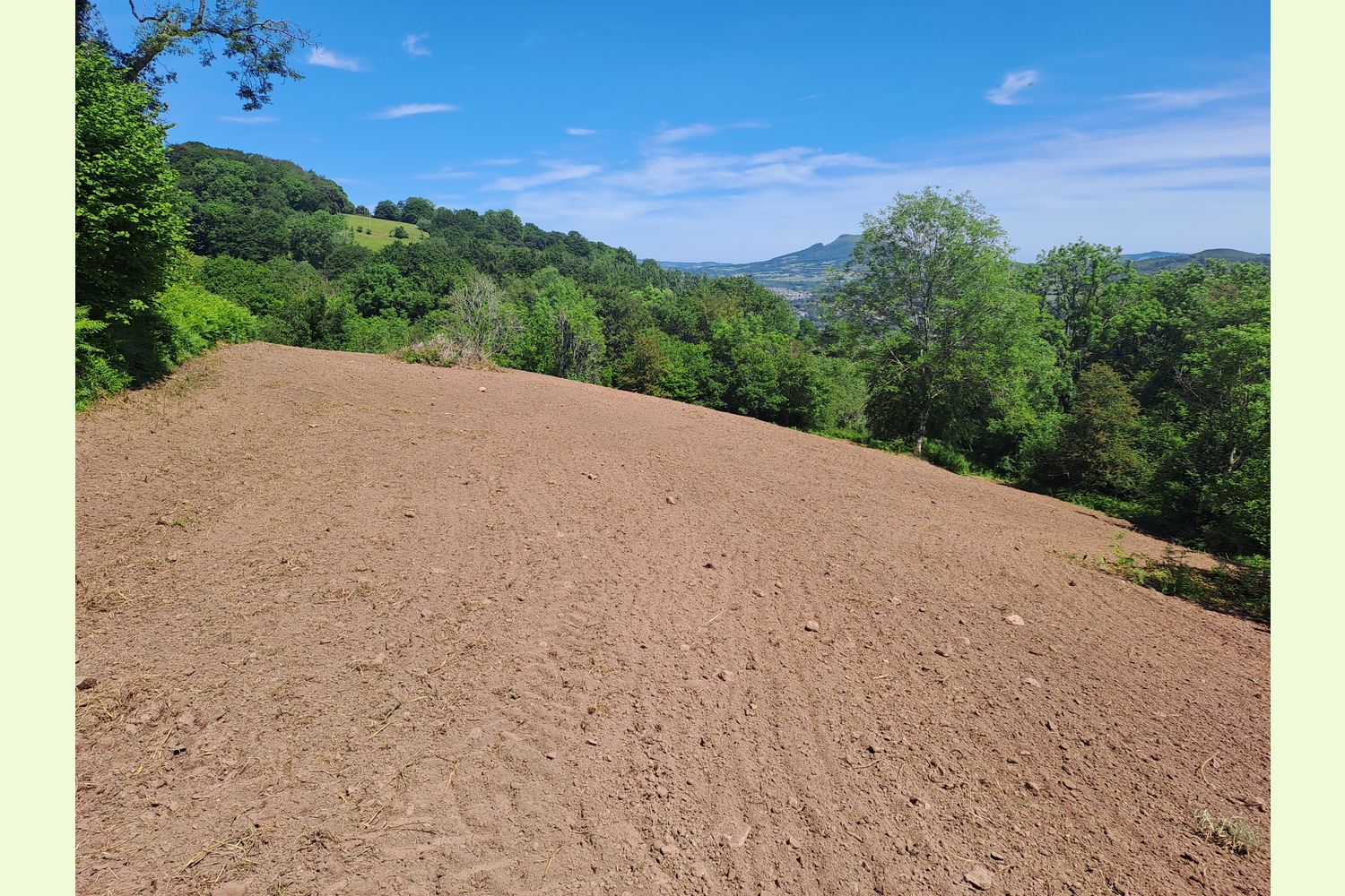
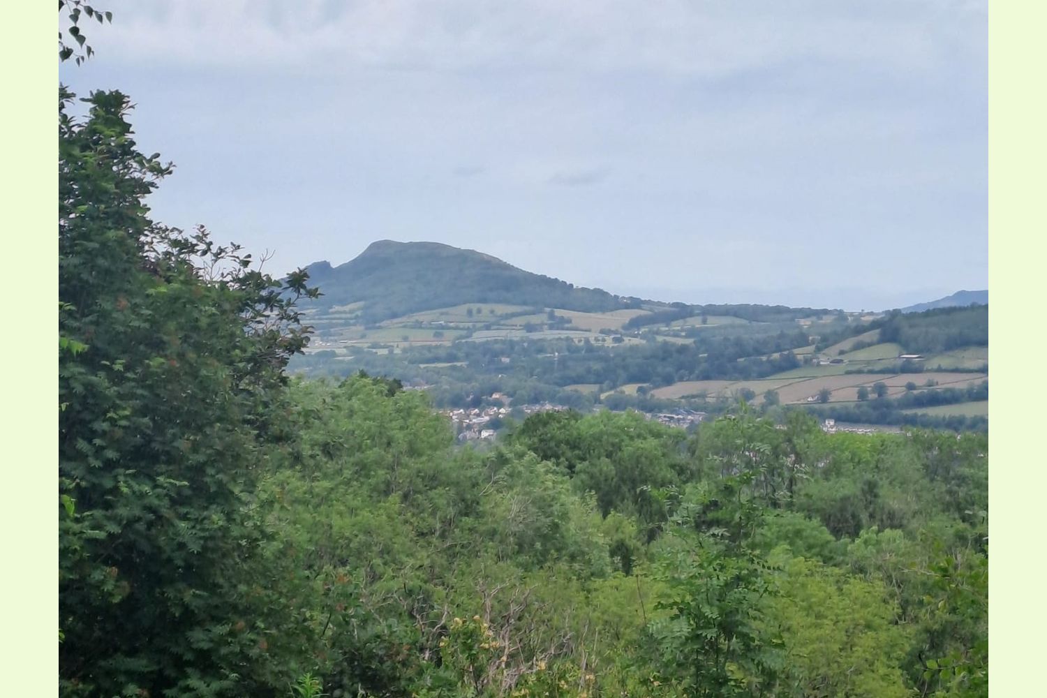
The Dingle is an amazing and diverse area of grassland and woodland, featuring good open grazing land (over 10 acres), broadleaf wooded dingles around two spring-fed water sources, mature conifer woodland (over 4½ acres), with two points of access from the public highway. It stretches nearly half a mile from its western tip at the highest point, down through the meadows and woodland, terminating with frontage onto the Monmouthshire & Brecon (Mon&Brec) canal. Rarely coming to market, it has the potential for mooring on the canal. The current owners have owned the land for 38 years. The Dingle is peaceful, private and has exceptional views across the valley towards The Skirrid and The Sugar Loaf Mountains.
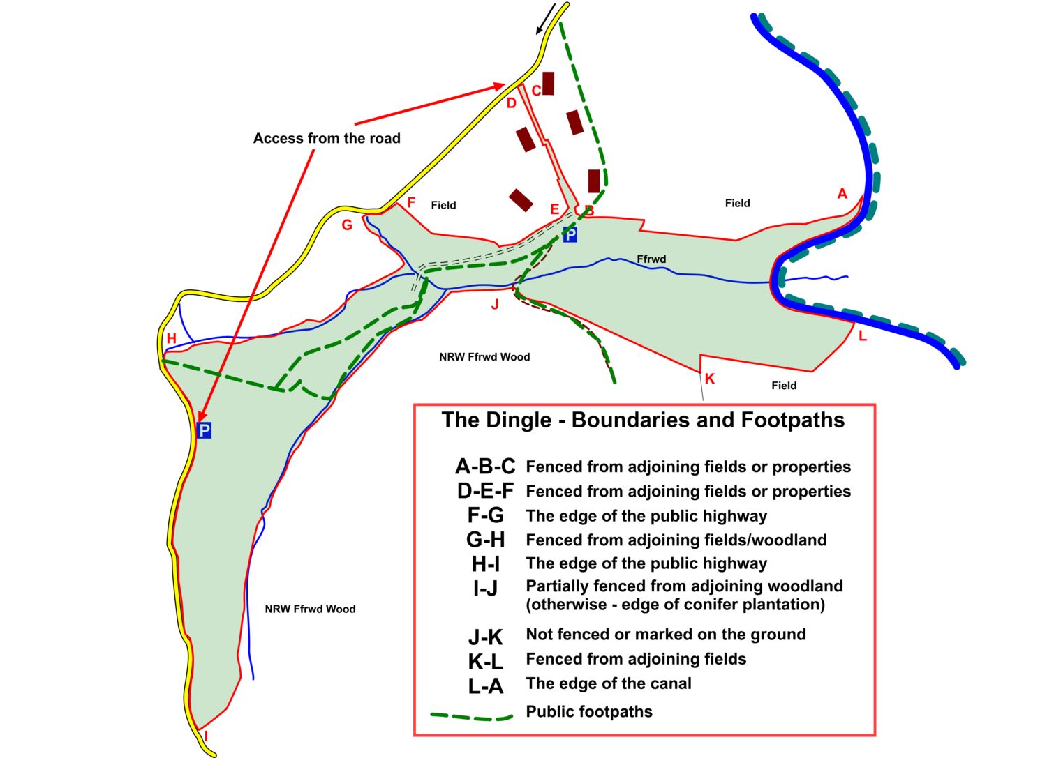
Access: There are two main points of vehicle access to The Dingle:
- From the public road at the highest, eastern, end of the land, where there is an entrance into the top meadow, that could easily be improved to provide hard-standing inside the entrance (see photo 24).
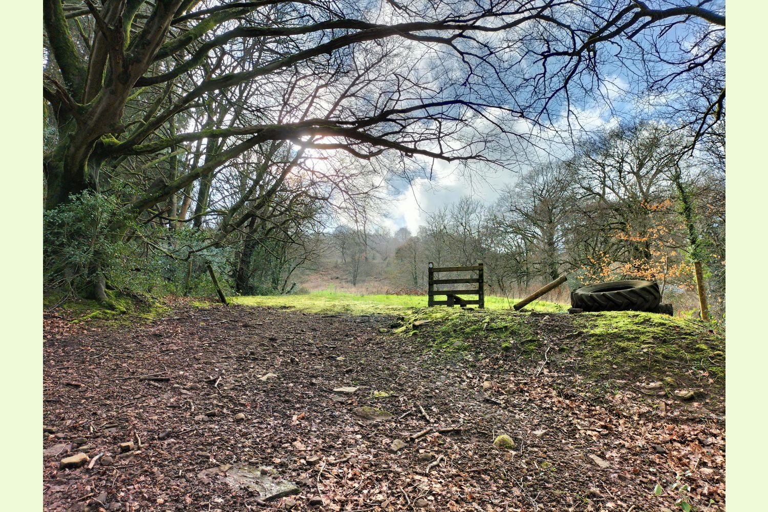
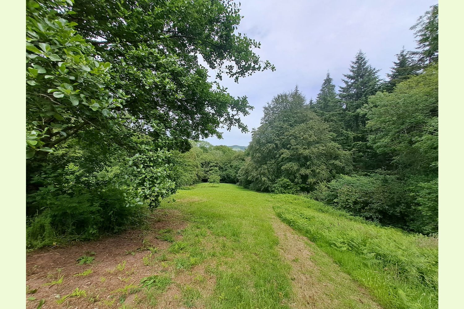
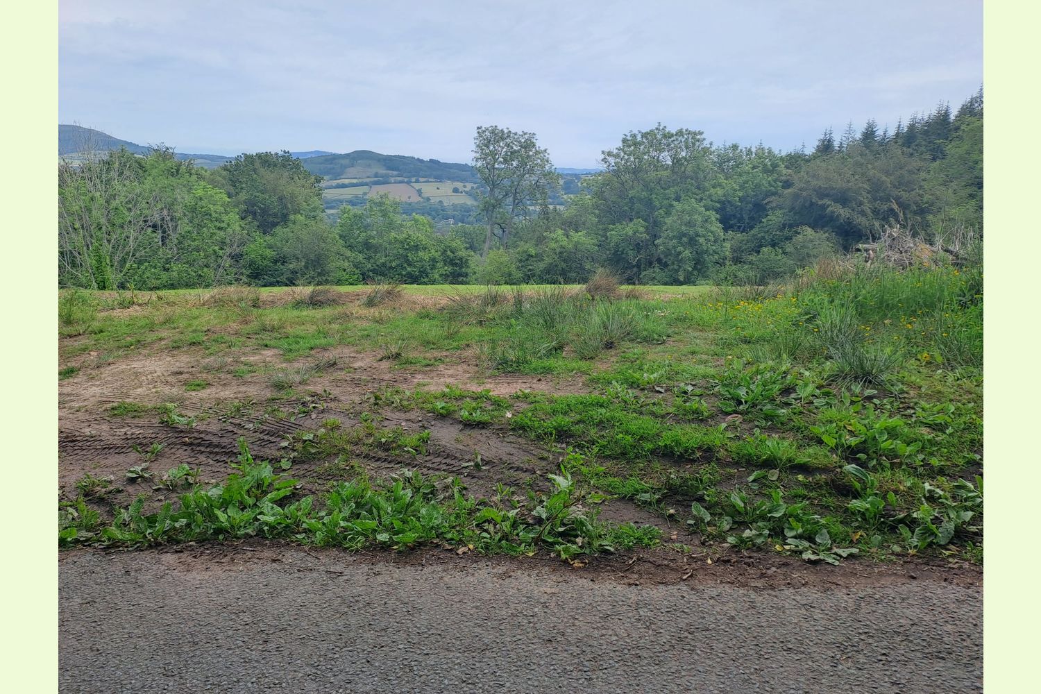
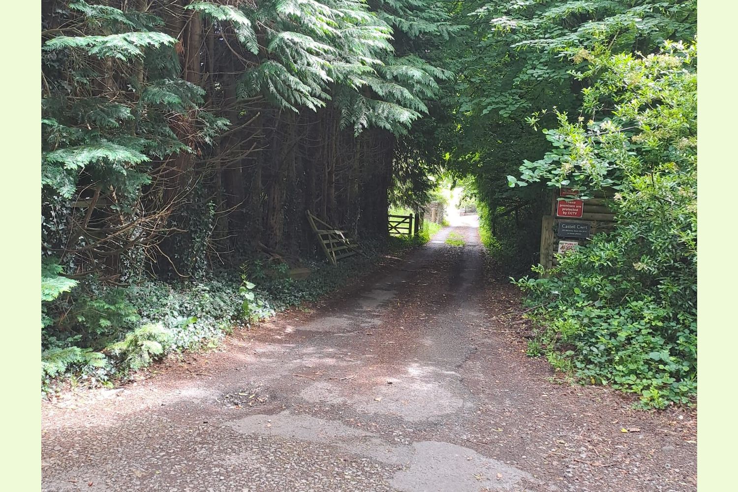
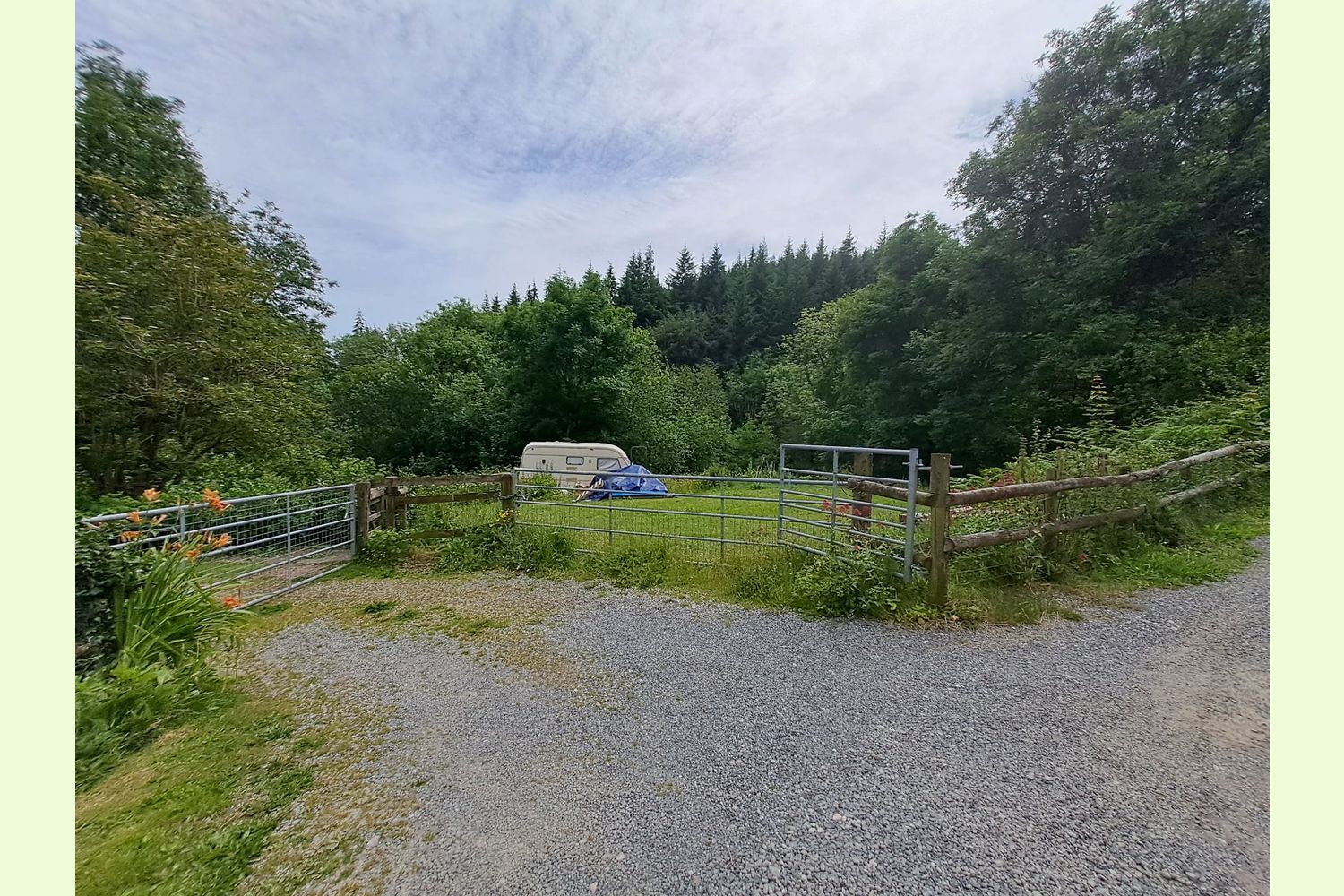
- From the public road towards the lower end of the land, where a driveway, part of the land, is shared with three properties (see photo 25). This driveway opens onto a gated flat grassland area (see photo 26), and then onto a track that runs through the middle of the wood, and provides access to the middle meadow, and also to the edge of the conifer woodland area.
Canal access: the level area next to the canal offers the possibility of mooring a canal boat or launching rowing boats or canoes (see photo 12 and 13), subject to any necessary Canal & River Trust permissions.
Public access: There are a couple of public footpaths through the dingle: one running from the road at the top of the hill, and one cutting through the middle and heading out of the wood above the area of Douglas Fir (see attached map). There is no public access in the Douglas Fir area or by the canal.
Sporting rights: Understood to be included.
Mineral rights: Included, except as reserved by statute.
Water supply: two springs supply water to the land, and one of these is also the water supply to the properties adjoining the main access driveway. These properties have a right to the water supply, and the owner of The Dingle has a right to make charges for the supply, (although the owners have not done so in recent times), and maintenance of the supply.
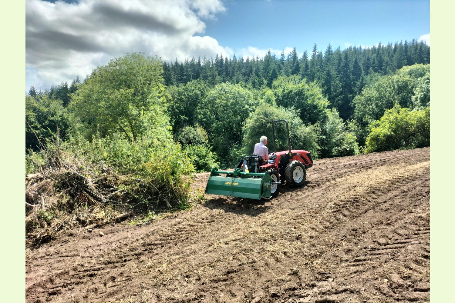
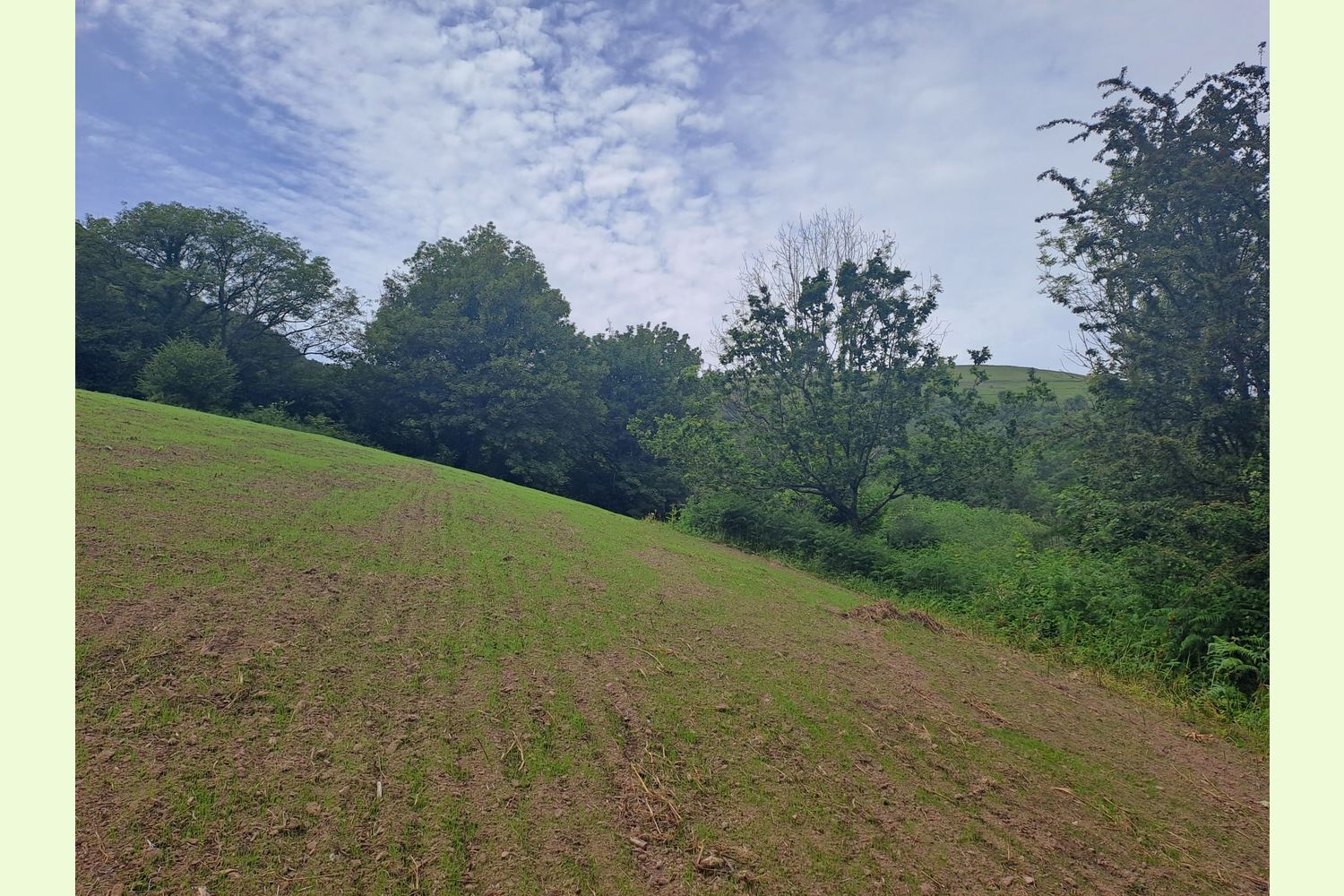
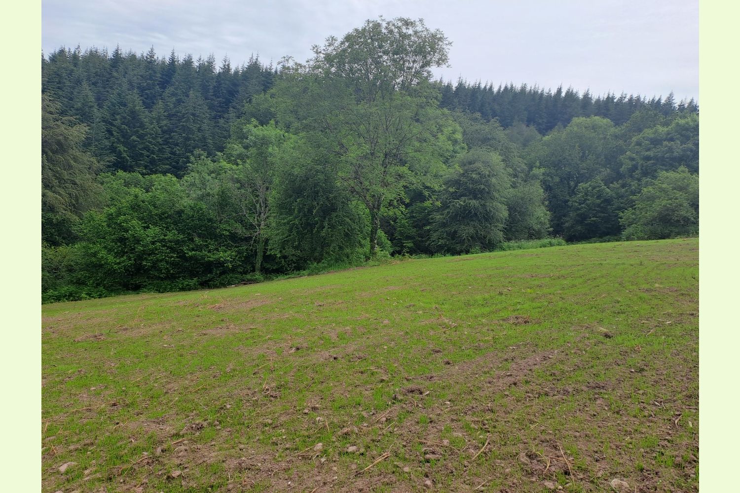
Meadows: There are two tree-lined meadows: the top meadow is about 7 acres, and has direct road access. It also offers magnificent views across the valley. It had become overgrown, and so has recently been mulched and reseeded. It features high quality soil, managed to organic standards, and historically only ever used for sheep and horse grazing.
The smaller middle meadow (about 3½ acres) has access from the driveway and track that runs through the dingle. These meadows are not fully fenced, but it would be possible to finish off the fencing to make them stock-proof, if desired.
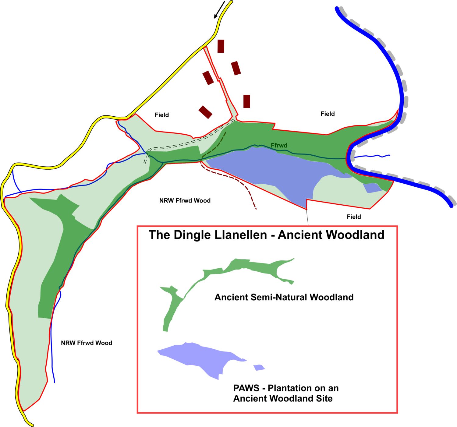
Ancient Woodland: Much of the Douglas Fir is designated as a Plantation on an Ancient Woodland Site (PAWS), the southern edge of the Top Meadow and the boundary between the Top and Middle meadows are Ancient Semi Natural Woodland, as is the area between the lower end of the middle meadow and the gateway at the end of the drive.
National Park: The Dingle falls within Bannau Brycheiniog (Brecon Beacons National Park) for planning purposes.
Boundaries: The majority of the boundaries are fenced from adjoining woodland and farmland, or are formed by adjoining roads (and the canal). There is a section of straight line boundary through the Douglas Fir, the position of which can be confirmed by the current owners.
Full details of the boundaries are on the attached boundaries plan.
Local area and history: The Monmouthshire & Brecon Canal (known locally as the "Mon & Brec") is a 35-mile navigable waterway winding through the Usk Valley and the Bannau Brycheiniog (Brecon Beacons) National Park in South Wales, between Brecon and Cwmbran. Renowned as one of Britain’s most picturesque canals, it is completely isolated from the rest of the canal network. It has only six locks, making it an incredibly relaxing route for boaters and paddlers.
The lower end of the wood is only a mile and a half from the nearest Waitrose, and two miles from Abergavenny.
Photographs: were taken in 2024 and 2026.
VIEWING: Strictly by appointment only. Please ensure that you have a copy of these sales details with you: we recommend either printing the details or downloading them to your phone/tablet/laptop before you go. Please take care when viewing as the great outdoors can contain unexpected hazards and woodlands are no exception.
Our Maps (Click on a map to see a large version)
Our Maps
Directions
Please note: Viewing strictly by appointment only.
From the he south via the M4 and the A4042, or from the east, via the A40
At the Hardwyck Gyratory, near Abergavenny, take the A465 Heads of the Valleys Road
After half a mile, take the next exit (by the Costa Drivethru) signposted Abergavenny/Y Fenni, Blaenavon and Llanfoist.
At the second roundabout, turn left signposted Blaenavon and Llanfoist.
From the west, on the A465 Heads of the Valley Road
Leave the A465 at the exit signposted Brecon (A40) and Llanfoist. Then turn right at the roundabout (next to Waitrose), signposted Blaaenavon and Llanfoist A4143, straight on through the traffic lights, and straight on at the next roundabout.
From all directions…
150 yards after the roundabout, at a mini roundabout, turn left onto Gypsy Lane (Lon y Sypsi) B4269.
After half a mile, take a right fork uphill (not signposted).
Follow this road over the canal bridge.
The driveway (see photo 25) leading to the parking area inside the land (photo 26 - code for combination lock required) is a quarter of a mile after the canal bridge.
Alternatively, continue up the hill, and the entrance to the top meadow, where there is room to park on the verge (see photo 24), is a further third of a mile.
If following SatNav, the entrance to the top meadow is at :
- Nearest postcode: NP7 9LE
(do not take the last turn – but continue a quarter of a mile up the hill)
- Coordinates: 51.79819, -3.03604
- What3Words: require.growl.over
The driveway is at:
- Nearest postcode: NP7 9LE (150 yards before reaching your destination)
- Coordinates: 51.80126,-3.0313
- What3Words: cultivation.officials.builders
Please note: the particulars with plans, maps, descriptions and measurements are for reference only and although carefully checked we cannot guarantee their accuracy and do not form part of any contract. Any intending purchasers must satisfy themselves by inspection or otherwise as to the correctness of these particulars.
Location maps
View and print this wood's location on Bing Maps »
Interested in this woodland? Get in touch with us:
Contact Sandra Colley on 07769654392 or email us at [email protected] with your details.