Troed Rhiw Groes, Carmarthenshire
Details for this wood
Guide price: £35,000 - Freehold
Size: Just over 3 acres
Location: Alltwalis, Carmarthenshire
OS Landranger: 146
Grid ref: SN443317
Nearest post code: SA32 7EB
Contact: Sandra Colley
Phone: 07769654392
Email: [email protected]
Email to a friend
***SOLD SUBJECT TO CONTRACT***
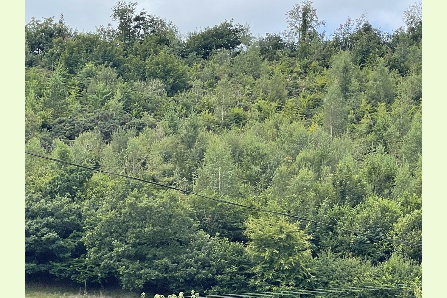
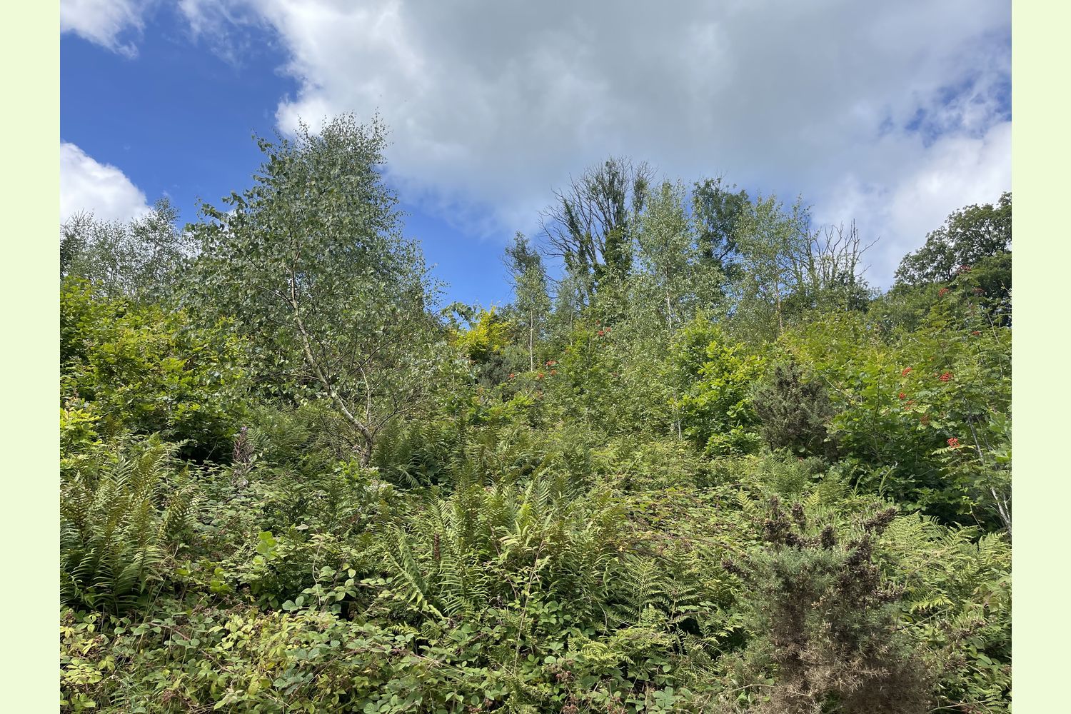
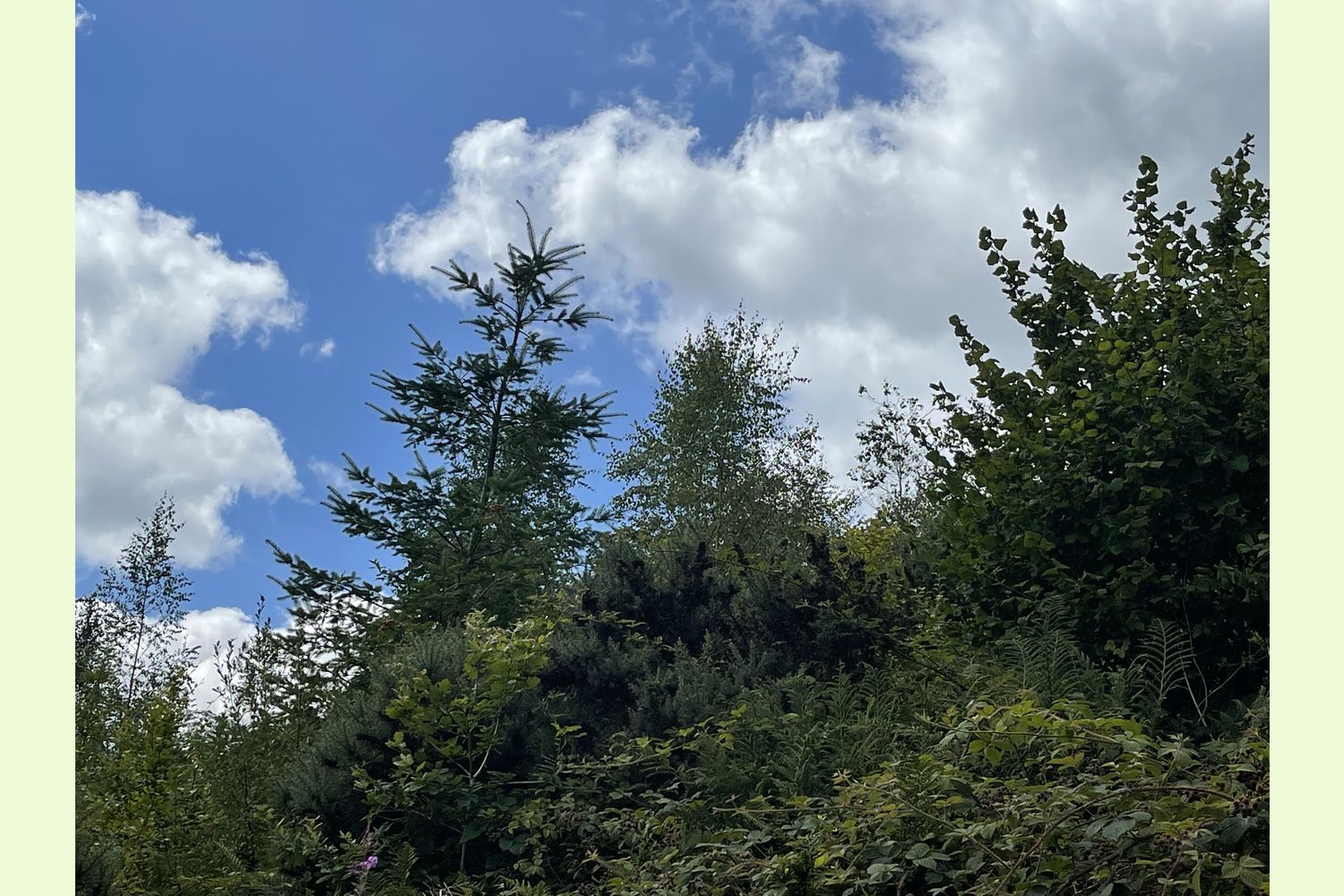
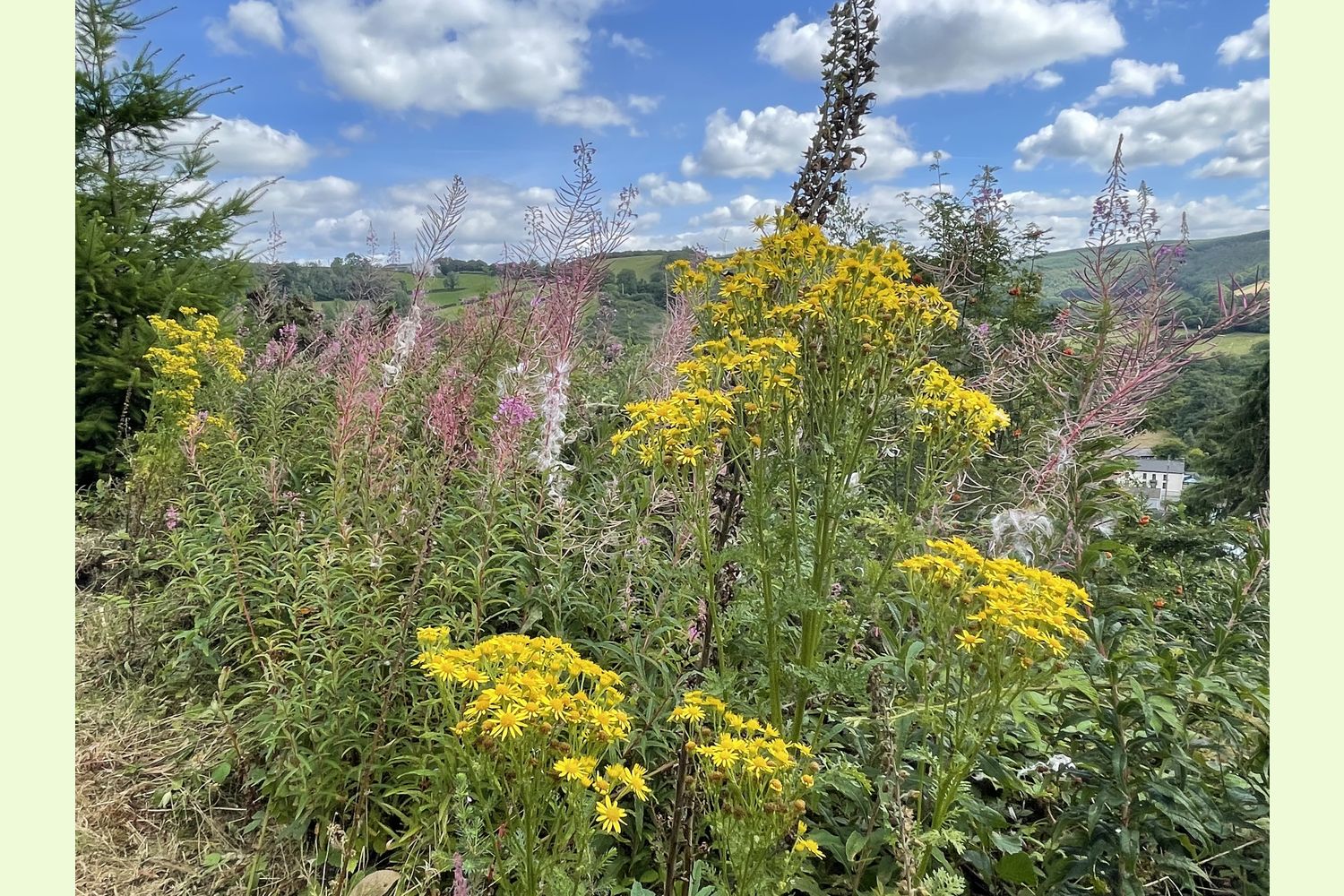
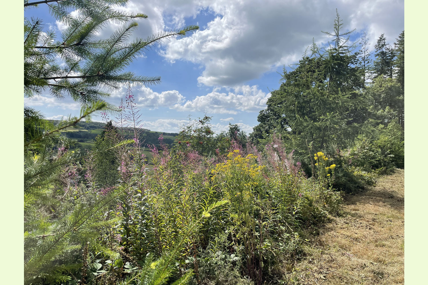
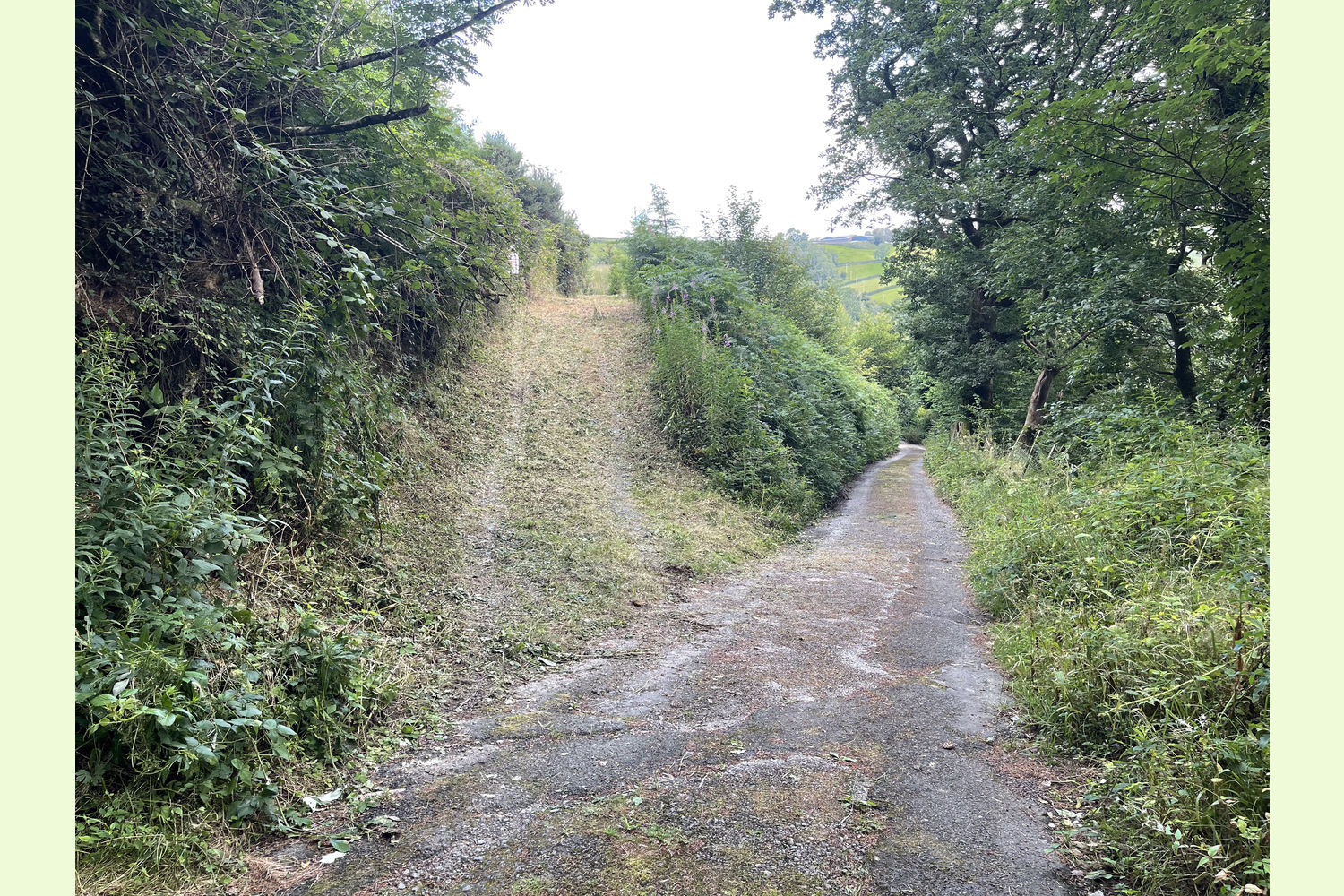
Description: Troed Rhiw Groes is a mostly young broadleaf woodland on the side of an east-facing slope, overlooking the hills of Brechfa Forest. The wood had previously been planted with a commercial conifer crop, but this was clearfelled by the current owners in 2014, and replanted with oak, beech, silver birch, cherry, horse chestnut, crabapple, maple and mountain ash the following year. There are a few naturally regenerated conifers dotted around the wood, but the majority is young broadleaf, with a smattering of more mature trees.
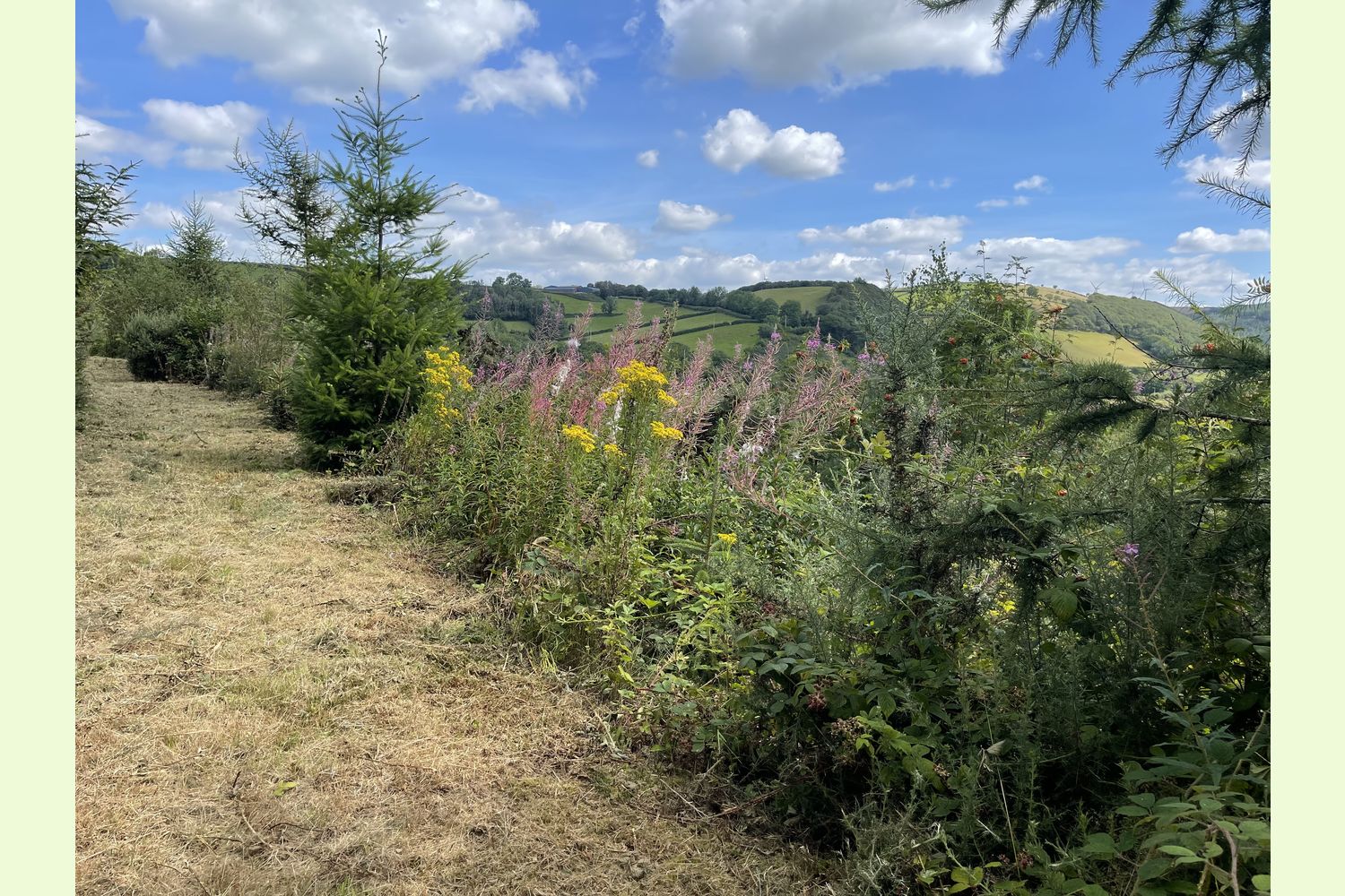
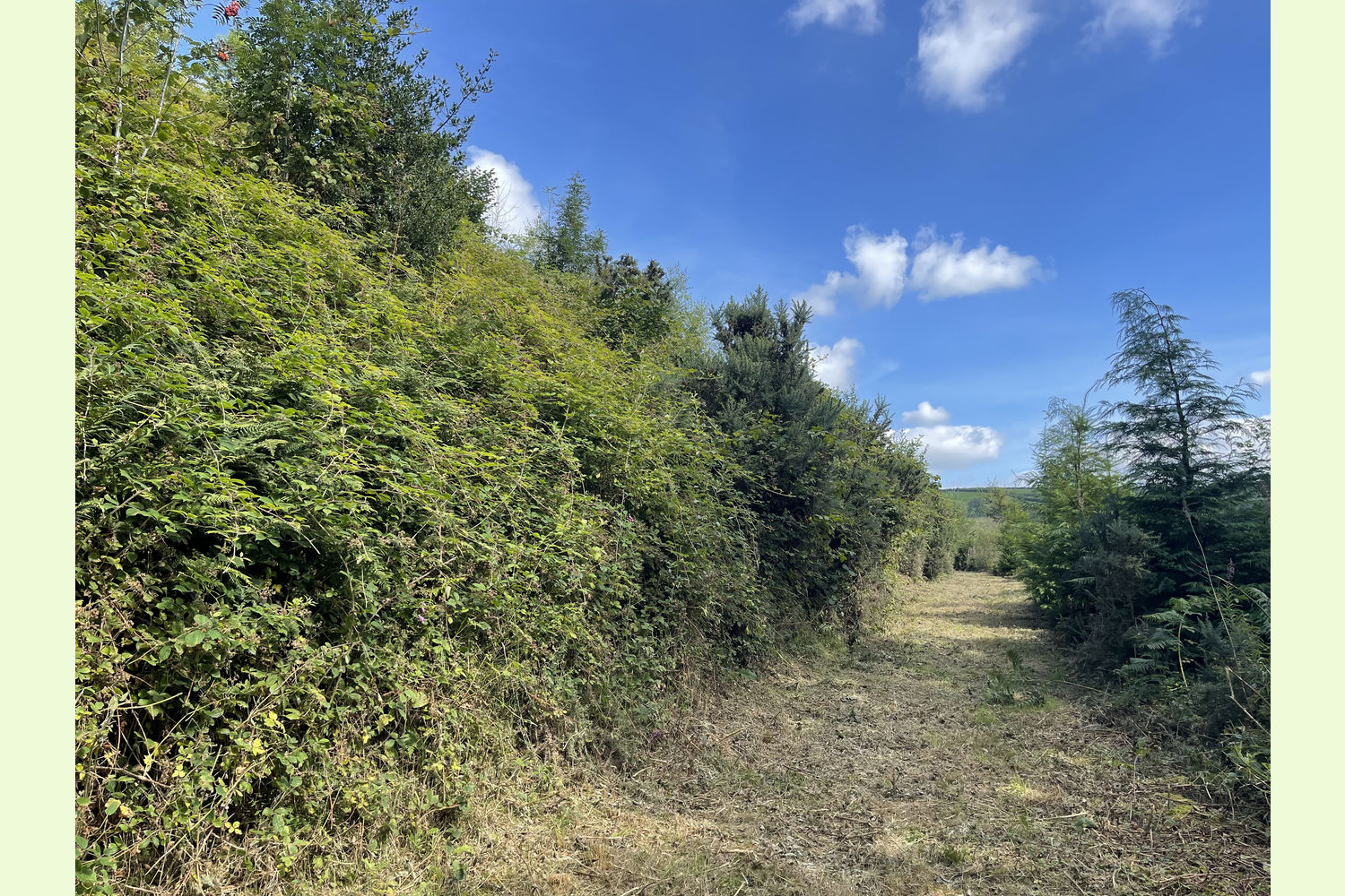
The main track through the woodland is clear, but any paths running through the woodland are now quite overgrown. Some work with a brushcutter would see those opened up, enabling access throughout the wood.
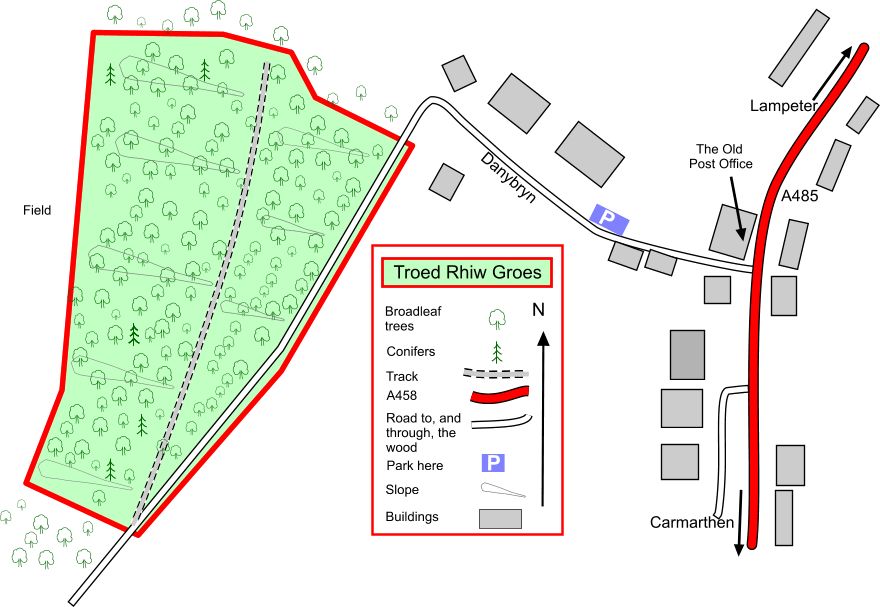
Access: The access to this woodland is excellent, and suitable for an ordinary car at any time. A tarmac road leads from the A485 Carmarthen to Lampeter road right up to the edge of the woodland. The tarmac continues within the wood, but is owned by the woodland. A farmer further up the tarmac road has a right of way over it, but it is not used by anyone else. A stoned track doubles back from near the southern boundary, and runs all the way through the wood towards the northern boundary.
Public access: The road running along the south-eastern boundary of the wood is a public footpath, but there is no public access along the track that doubles back through the wood, or through the wood itself.
Sporting rights: Understood to be included.
Mineral rights: Included, except as reserved by statute.
Boundaries: The western and northern boundaries are fenced from adjoining farmland. The eastern boundary is the edge of the access road. The southern boundary is with adjoining woodland, and understood not to be fenced.
Local area and history: This woodland is on the edge of the small hamlet of Alltwalis. The next nearest village is Pencader, just three miles to the north, where there is a shop and a bakery, although there is a convenience store at the Windy Corner Garage, just a mile up the hill. A few yards from the wood is Yr Hen Tollborth (The Old Tollhouse), built in the middle of the 19th century. Tolls were payable by travellers and merchants who were on their way to the old market town of Carmarthen. Just on the south of the tollbooth is an old woollen mill, now residential houses, called ‘The Factory’. This mill was deliberately placed to the Carmarthen side of the tollgate so that no tolls would need to be paid there!
Photographs: were taken in August 2022.
VIEWING: You are welcome to visit this wood by yourself. Please ensure that you have a copy of these sales details with you: we recommend either printing the details or downloading them to your phone/tablet/laptop before you go. Please take care when viewing as the great outdoors can contain unexpected hazards and woodlands are no exception.
Our Maps (Click on a map to see a large version)

Our Maps
Directions
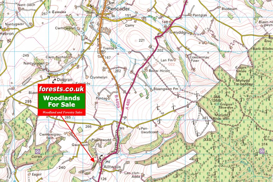
The woodland is at the end of a side road off the A485 Carmarthen to Lampeter road.
From Carmarthen and the south
Take the A485 signposted to Lampeter.
Follow this road for six and half miles, through Peniel and Pontarsais, until you reach Alltwalis.
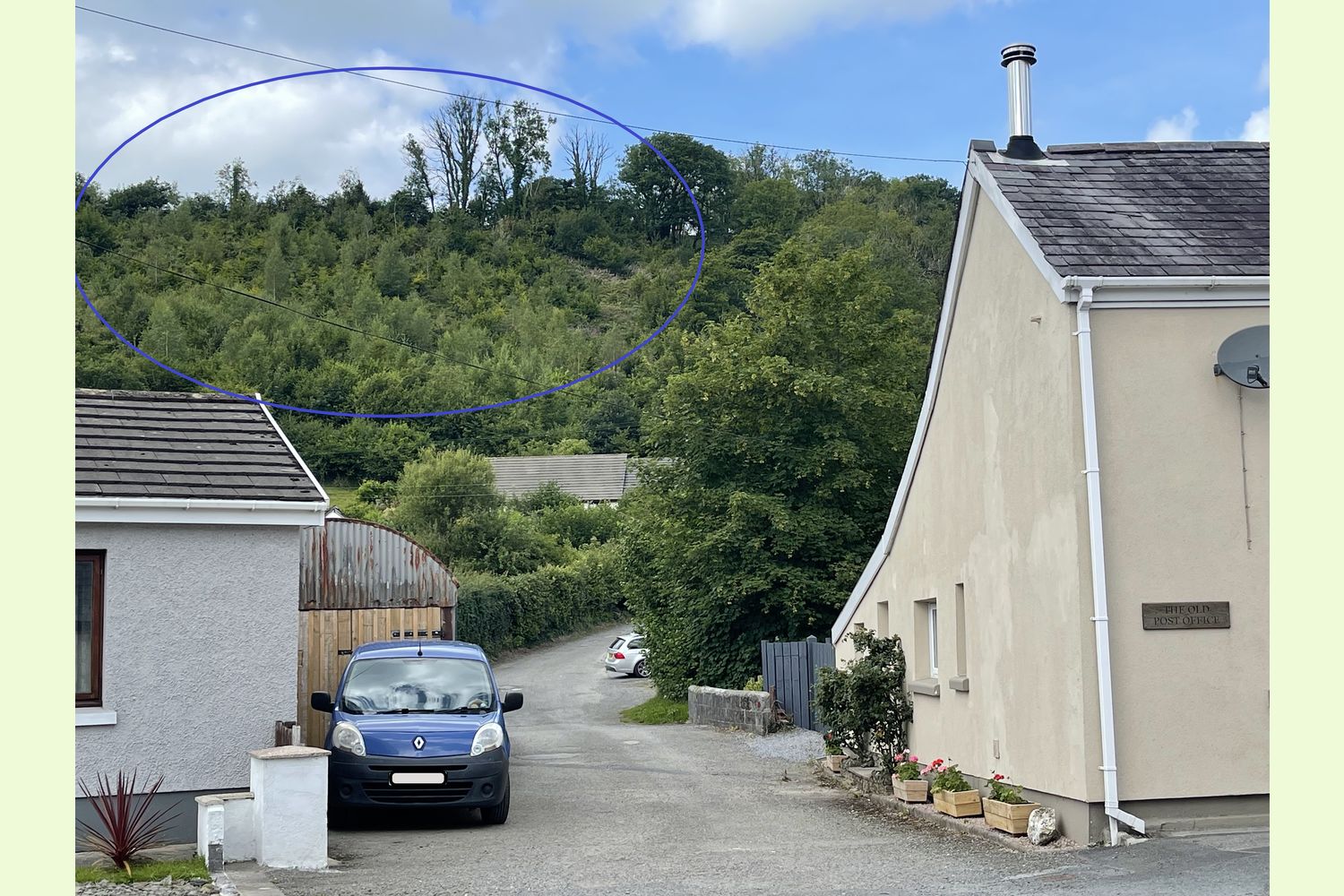
Go over the speed bumps, past a private road, and look for a small road on the left, just before "The Old Post Office", which is just before the old chapel and churchyard. It is an easy turning to miss (see the last photograph).
From Cwmann, just east of Lampeter:
Take the A485 signposted Llanybydder and Carmarthen:
Follow this road for 14 miles, through Llanybydder, Llanllwni and New Inn.
After the chapel and churchyard on the right, take the small turning just after the next building, the "Old Post Office".
A few yards after turning off the main road, there is room to park on the right hand side of the road. Please note: this is a private road. Take care not to park in front of the houses, or blocking access. Carry on up the road on foot to the next turning to the left. This is the start of the road that runs through the woodland.
- Postcode: SA32 7EB (opposite the turning off the A485)
- What3Words: race.tripling.finishing (turning off the A485)
- Coordinates: 51.96247, -4.26389 (turning off the A485)
- 51.96276,-4.26557 (start of the woodland road)
Please note: the particulars with plans, maps, descriptions and measurements are for reference only and although carefully checked we cannot guarantee their accuracy and do not form part of any contract. Any intending purchasers must satisfy themselves by inspection or otherwise as to the correctness of these particulars.
Location maps
View and print this wood's location on Bing Maps »
Interested in this woodland? Get in touch with us:
Contact Sandra Colley on 07769654392 or email us at [email protected] with your details.