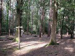
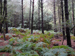
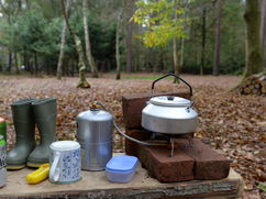
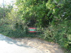
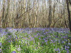
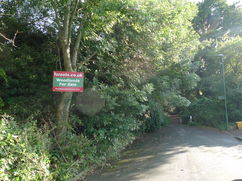
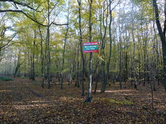
Woodlands for Sale in South East England
You are welcome to visit our woodlands with our sales details. For more information and all enquiries contact Ben Williamson:
- Phone: 07958 213 914
- Email: ben@forests.co.uk
Email updates
We send out an email update whenever we advertise a new woodland or forest for sale.
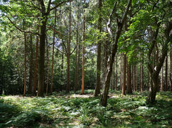
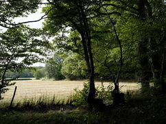
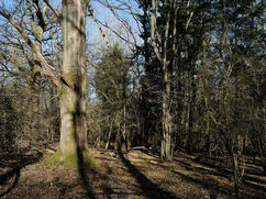
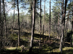
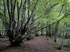
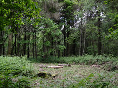
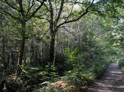
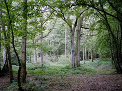
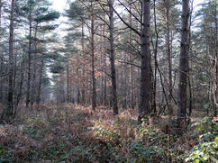
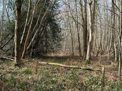
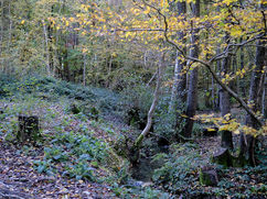
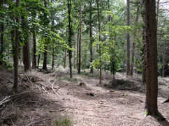
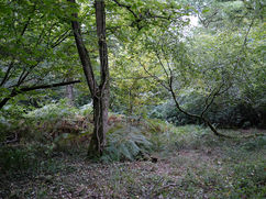
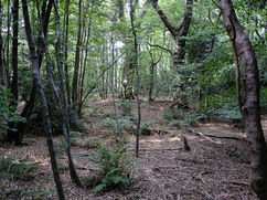
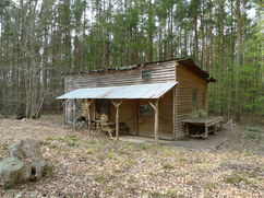
Dreamweaver - East Sussex About 2½ acres | £55,000 Freehold
Dreamweaver Wood is a peaceful, secluded woodland nestled within the High Weald National Landscape, just a short drive from the coast.
This charming woodland offers an ideal opportunity…
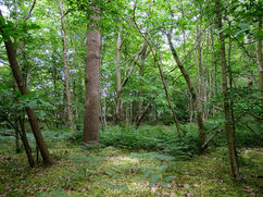
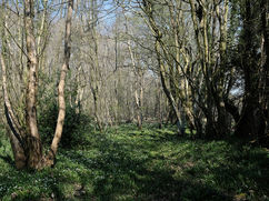
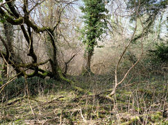
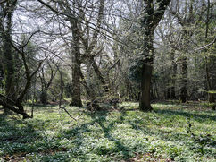
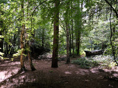
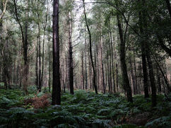
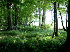
Rooks Hill - Surrey 12 acres | £195,000 Freehold
Rooks Hill presents a rare chance to own a distinctive piece of ancient and semi-ancient woodland within the South Downs National Park.
A wide access track runs along…
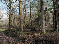
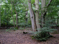
Birches Wood (part) - Under Offer About 1 acre | £25,000 Freehold
Birches Wood (part) is a small yet enchanting ancient woodland, tucked just south of the Surrey Hills Area of Outstanding Natural Beauty (AONB).
Covering just one acre, it's…
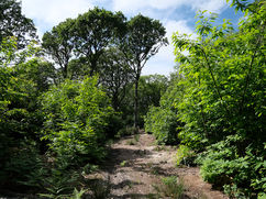
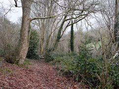
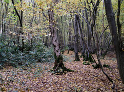
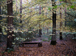
Shepherd's Myrtle Wood - East Sussex About 5 acres | £80,000 Freehold
Shepherds Myrtle is a secluded area of ancient and semi-natural woodland, located just a short drive from the south coast.
The woodland primarily comprises of semi-mature chestnut coppice, interspersed with…
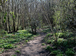
Hornbeam Wood - Kent About 5¼ acres | £85,000 Freehold
Hornbeam Wood offers a chance to own a peaceful, secluded woodland with stunning open views to the south. As the name suggests, hornbeam dominates the lower levels of the forest,…
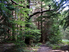
Tun Wood - Kent About 8½ acres | £130,000 Freehold
Tun Wood is a large and secluded area of ancient and semi-natural woodland, nestled at the far end of the broader Brewers Wood. Its peaceful setting makes it an ideal…
Hoath Wood - East Sussex 11¼ acres | £170,000 Freehold
Hoath Wood is a wide spanning plantation on ancient woodland (PAWS) set within the High Weald AONB.
The woodland stock itself is well mixed. Some areas of chestnut…
Mail Wood - Under Offer About 7½ acres | £80,000 Freehold
Mail Wood is an accessible area of ancient, replanted woodland located on the edge of Langley Heath.
The woodland has been largely replanted with sweet chestnut coppice, though some magnificent…
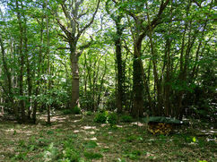
Beadles Wood - Surrey About 4½ acres | £82,000 Freehold
Beadles Wood is a light, open and well mixed woodland in the idyllic county of Surrey.
As you enter the woodland, mature oak, conifers, ash, and beech trees greet you.…
Fryarne Park Wood (part of) - Under Offer About 1½ acres | £29,500 Freehold
Fryarne Park Wood (Part) presents a rare chance to own a small yet stunning piece of ancient English woodland, set within the heart of the Kent Downs Area…
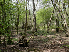
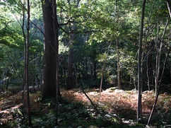
Dens Wood - East Sussex About 8 acres | £140,000 Freehold
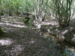
Dens Wood is a truly distinctive woodland, bordered by a gentle stream and nestled within the scenic High Weald National Landscape.
The southern part of the site is…
Bent Oak & Northridge - Kent About 14 acres | £197,000 Freehold
Bent Oak & Northridge offer the opportunity to own a significant mixed broadleaf woodland located within the Old Park Wood Site of Nature Conservation. These combined woodlands have been meticulously…
Sable Wood - Surrey About 6 acres | £105,000 Freehold
Sable Wood presents a unique opportunity to become a steward of a cherished local woodland on the outskirts of Farnham.
While Scots pine dominates the landscape, the woodland is also…
Heathgate Wood - Under Offer About 6½ acres | £120,000 Freehold
Heathgate Wood is a semi-ancient broadleaf woodland nestled within the South Downs National Park, just outside the market town of Arundel.
A hard track leads from the main…
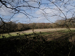
Star Wood - Surrey 7 acres | £120,000 Freehold
Star Wood is an expansive semi-ancient broadleaf woodland, featuring wide rides and open fields to the south.
Majestic, well-spaced oaks dominate the landscape, giving the woodland a grand and spacious…
Primrose Rew Wood - Surrey About 3 acres | £48,000 Freehold
Primrose Rew Wood presents a rare chance to own a beautiful piece of ancient woodland in the Surrey Hills Area of Outstanding Natural Beauty (AONB).
This woodland is…
Dering Lodge Wood - Kent About 21 acres | £270,000 Freehold
Dering Lodge Wood is an important example of ancient woodland and set within a Local Wildlife Site which makes up part of the much larger Dering Wood.
The site comprises…
Fryarne Park Wood (Part) - Kent About 4¼ acres | £75,000 Freehold
Fryarne Park Wood (Part) is a stunning example of ancient English woodland nestled within the Kent Downs Area of Outstanding Natural Beauty (AONB).
The woodland's history is immediately…
Etchden (Part) 2 acres | £43,000 Freehold
Etchden Wood (part) is perfect for those considering owning their own woodland retreat and at 2 acres is a very manageable size.
Tucked away in a quiet corner of the…
Quarry Wood - Marlow About ¾ of an acre | £29,500 Freehold
Quarry Wood is a small woodland set in a fantastic location, just a short walk from the River Thames in Marlow.
The wood itself is well mixed, hazel is dominant…
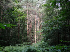
Forge Wood - East Sussex About 15 acres | £210,000 Freehold
Forge Wood is a gently sloping site in a well-wooded area of low hills set in the High Weald AONB.
Sitka spruce was planted in about 1960 and Forge Wood…
Steam Wood - East Sussex About 4 acres | £70,000 Freehold
Steam Wood is a secluded woodland nestled within Limekiln and Park Woods in the High Weald Area of Outstanding Natural Beauty (AONB).
The forest is predominantly composed of…
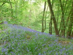
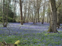
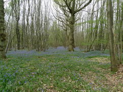
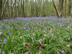
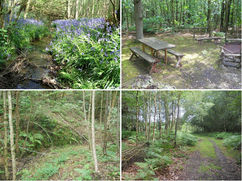
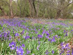
Bluebell Wood - Sold About 12 acres | £195,000 Freehold
Bluebell Wood is a wonderful example of ancient, semi-natural broadleaf woodland nestled deep within the High Weald.
Among the towering oak and beech trees, a rich tapestry of species thrives…
Fox Wood - Sold About 4¼ acres | £80,000 Freehold
Fox Wood, nestled within the Old Park Wood Site of Nature Conservation, offers an excellent opportunity for those interested in owning a woodland.
This woodland features a variety of trees,…
Tower Wood - Sold About 5 acres | £85,000 Freehold
Tower Wood is a secluded broadleaf woodland, nestled between the High Weald Area of Outstanding Natural Beauty (AONB) and the South Downs National Park.
Accessible via…
Kiln Wood - Sold About 1¼ acres | £32,000 Freehold
Kiln Wood is a charming and secluded woodland tucked away behind a peaceful residential street in the Berkshire countryside. Spanning 1¼ acres, this compact woodland is rich in character, featuring…
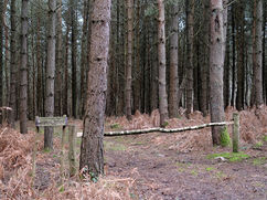
Signal Wood - Sold About 8 acres | £110,000 Freehold
Signal Wood is a wonderfully light and spacious woodland overseen by towering Corsican pine.
From the entrance, an excellent vehicle track leads you down into the woodland to a…
Batcher Wood - Kent - Sold 5 acres | £98,000 Freehold
Batcher Wood is a stunning semi-ancient mixed woodland that provides complete seclusion on the edge of the High Weald (AONB). Located at the far end of a winding…
Went Wood - Kent - Sold About 7 acres | £115,000 Freehold
Went Wood offers the opportunity to own an exceptional broadleaf woodland nestled in the heart of the Kent countryside.
This ancient, semi-natural woodland is primarily hornbeam coppice of various ages,…
Funnel Wood - Sold About 7 acres | £115,000 Freehold
Funnel Wood is a fantastically light and spacious mixed woodland, overseen by towering Scots and Corsican pine.
As you wander further into the wood, both mature and young oak and …
Morning Copse - Sold About 2¼ acres | £38,000 Freehold
Morning Copse is a tranquil and diverse woodland nestled on the edge of the Kent Downs AONB. Spanning just over two acres, this manageable-sized woodland is ideal for…
Brightstone Copse - Sold Over 3½ acres | £68,000 Freehold
Brightstone Copse, a woodland of Scots and Corsican pine planted to shelter and nurse the beech trees now at a semi-mature stage, sits on the upper parts of a homely…
Shoal Wood - Sold About 4¾ acres | £80,000 Freehold
Shoal Wood is predominantly Scots pine on the surface but as you enter the woodland an impressive understory emerges. Chestnut is dominant but also, birch, oak, ash and holly can…
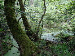
Pennywort Wood - Sold 25½ acres | £280,000 Freehold
Pennywort Wood offers a rare opportunity to own a large well-mixed woodland in the High Weald AONB.
The woodland boasts fantastic features including a stream fed by a…
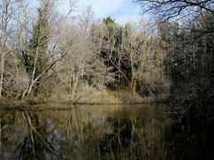
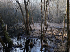
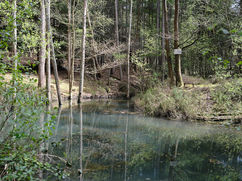
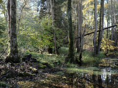
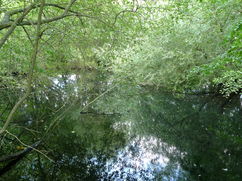
Lyde Wood - Sold About 5¾ acres | £110,000 Freehold
Lyde Wood is a wildlife sanctuary featuring diverse broadleaf trees and scenic river frontage.
The woodland is predominantly home to towering alder trees, reaching heights of at least 30 meters.…
Capstan Wood - Sold About 4½ acres | £95,000 Freehold
Capstan Wood is a mixed semi-ancient woodland set within the South Downs National Park on the outskirts of Arundel.
Upon entering the woodland, towering Scots pine surround you…
Marron Wood - Sold 5 acres | £88,000 Freehold
Marron Wood is a secluded broadleaf woodland nestled within the Old Park Wood Site of Nature Conservation and offers a tranquil retreat spanning 5 acres, making it an ideal choice…
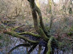
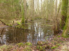
Cathill Wood - Sold About 10 acres | £145,000 Freehold
Located in pretty Surrey countryside within easy reach of the M25 if needed, Cathill Wood has a stream running through the centre of the wood which at points is dominated…
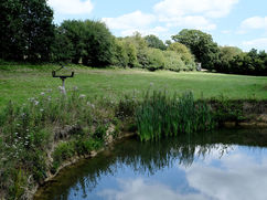
Priory Wood - Hampshire - Sold About 4 acres | £65,000 Freehold
Priory Wood is a wonderfully mixed woodland with wide rides and numerous ponds attracting a wealth of wildlife.
Mature oak and ash are dominant within the wood but also birch,…
Bough Beech Wood - Sold 6 acres | £125,000 Freehold
Bough Beech Wood provides a rare opportunity to own a completely private woodland surrounded by open fields, situated between the Surrey Hills AONB and also the
Trencher Wood - Sold About 4¾ acres | £98,000 Freehold
Trencher Wood is a wonderful semi-ancient mixed broadleaf woodland with great views and a lovely stream.
The secluded woodland lies towards the far end of a shared woodland track …
Uprising Coppice - Sold About 2½ acres | £45,000 Freehold
Uprising Coppice is an ancient broadleaf woodland with lots of variety and character set within the High Weald AONB.
As the name would suggest a majority of the woodland…
Hitch Wood - Sold About 5½ acres | £135,000 Freehold
Hitch Wood is a magical ancient woodland set within the South Downs National Park just a stone's throw from the coast.
The woodland itself is a well mixed, mature…
Alder Gill - Surrey - Sold About 4 acres | £85,000 Freehold
Alder Gill is a well mixed semi-ancient woodland in a private and secluded setting within the Mole Valley.
Mature oak and beech are common throughout but also alder, hornbeam, birch,…
Langley Wood - Sold Almost 5 acres | £95,000 Freehold
Langley Wood provides a rare opportunity to own a truly enchanting woodland in the The New Forest with easy access to the south coast.
As you enter the wood…
Cullens Hill Wood - Sold About 2½ acres | £30,000 Freehold
Cullens Hill Wood is a small well mixed woodland located in the picturesque village of Elham within the Kent Downs AONB.
The woodland itself has been untouched by human …
Neck Wood - Kent - Sold About 9 acres | £50,000 Leasehold
Neck Wood is located near the small hamlet of Ewell Minnis and the village of Alkham.
The woodland is surrounded by open fields on most sides and well positioned on…
Forest Bank - Kent - Sold About 1½ acres | £30,000 Freehold
Forest Bank is the ideal starting point for those considering owning a woodland. At 1½ acres, Forest Bank is a very manageable size and has some lovely features.
Mature oak…
Downstream Wood - East Sussex - Sold About 6¾ acres | £120,000 Freehold
Downstream Wood is semi-natural ancient woodland, and set within the High Weald Area of Outstanding Natural Beauty. There is a wide variety of trees including, mature oak, ash,…
Hamsell Shaw - East Sussex - Sold About 3¾ acres | £85,000 Freehold
Hamsell Shaw is a wonderful mix of woodland and open meadow set in the High Weald AONB, ideal for those considering owning their own woodland or starting a rewilding…
Great Gorse Shaw - Sold About 8 acres | £195,000 Freehold
Great Gorse Shaw is a truly unique, well mixed private woodland situated in the Kent Downs Area of Outstanding Natural Beauty. From the secure private gates, a hard track leads…
Cherishland Farm Wood - Sold Almost 2 acres | £42,000 Freehold
Although its a small wood it does have most things desirable in a woodland:
- it's south facing;
- has wonderful views to the North Downs in the distance;
- has …
Gantry Wood - Sold About 6¾ acres | £98,000 Freehold
Gantry Wood is a wood with a hidden surprise. The approach to the wood is along an all-weather restricted byway, and then a stoned private woodland track. The pine wood…
Wedmans Wood - Sold About 3⅓ acres | £70,000 Freehold
Wedmans Wood is a very private, manageable woodland within easy walking distance of the village of Rotherwick.
Mature oak, beech, birch, hazel and chestnut are common but also field…
Chaff Wood - Sold About 5¾ acres | £90,000 Freehold
Chaff Wood is some distance from the nearest main road and as such is a very peaceful woodland just a short distance from the picturesque village of Petham and set…
Aconite Wood - Sold About 7¾ acres | £115,000 Freehold
Aconite Wood is the largest of four small woodlands comprising Tye Wood, on the borders of the picturesque village of Elham in East Kent.
The wood is classified as…
Goldeneye Wood - Sold About 3¾ acres | £78,000 Freehold
Goldeneye Wood is a beautifully open, peaceful woodland with lots of character. Winding pathways lead you in and around the wood to various clearings and points of interest.
Goldeneye Wood…
Little Millhole Wood - Sold Around 24 acres | £325,000 Freehold
Little Millhole is a fantastic mix of old and new woodland set just a few miles from Tunbridge wells. Little Millhole sits beside the larger Big Millhole Wood, both of…
Corsican Wood - Sold Around 12½ acres | £205,000 Freehold
Corscian Wood is a large, peaceful space, ideal for families or those looking for a private woodland. Nestled between the villages of Goudhurst and Cranbrook, Corsican wood is easily accessible …
Tap Wood - Sold About 2½ acres | £40,000 Freehold
Tap Wood is a very manageable size and unusually, bordered by fields on three sides making it a very private space. It would be a perfect first purchase for someone…
Fryarne Park Wood - Sold About 2 acres | £30,000 Freehold
Fryarne Park Wood is a very manageable wood in a lovely location, ideal for camping and woodland activities. Situated near the quiet village of Stelling Minnis and only a short …
Hornbeam Wood - Sold About 5 acres | £75,000 Freehold
Hornbeam Wood as the name would suggest is mainly made up of coppiced hornbeam, an excellent firewood, over which are mature oaks. There are numerous open areas and the wood…
Hurst Wood - Sold Almost 5 acres | £86,000 Freehold
Located in the beautiful High Weald AONB (area of outstanding natural beauty) and part of Great Knelle Wood all of which add their share of trees to this special…
The Broom at Oakhill - Sold About 8¼ acres | £120,000 Freehold
A quiet ancient woodland set in beautiful East Sussex countryside yet easily access. The High Weald AONB designation (click for details) recognises the pretty landscape of the area and…
Pilot Wood, Arundel - Sold Almost 6 acres | £130,000 Freehold
A perfect woodland being level with coppiced hazel and sweet chestnut together with some mature oaks and occasional Scots pine, silver birch, field maple, beech and holly. A plentiful supply…
Deuturs Wood - Sold About 4¼ acres | £85,000 Freehold
Principally Norway spruce woodland set in strikingly beautiful hilly and wooded scenery, where a winter stream flows along the eastern boundary. The spruce is well-grown and ready for thinning which…
Park Wood - Sold About 3½ acres | £56,000 Freehold
Park Wood is part of the larger Roman Wood, the wood contains a wealth of oak, fir and hazel. The fir is large and well-grown and towers above the hazel…
Strawberry Wood - Sold About 5 acres | £80,000 Freehold
Good mature woodland, with the formality of gounds around a grand house and gardens, it's also part of the Conservation Area, a designation which recognised the historic value of…
Stonegate Wood, Ruckinge - Sold About 5½ acres | £82,000 Freehold
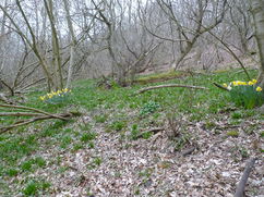
Stonegate Wood has most features to make it the ideal conservationists and family woodland. Good quality mature oak, over hazel coppice, seasonal streams, lots of bluebells, flat and easy internal…
Paddock Wood - Sold About 10 acres | £120,000 Freehold
Undoubtedly ancient woodland long before planting of Grand fir in the 1960's, Paddock Wood is now considered to be a plantation on ancient woodland site. Most of the conifer was…
Finch Wood - Sold About 10 acres | £85,000 Freehold
Finch Wood is to the western end of the much larger Capel Woods, aka Mounts Wood, and these are part of the extensive woodlands identified in the SNCI (site of…
Caledonian Wood - Sold Over 19 acres | £300,000 Freehold
A magnificent woodland in a magnificent location. A conservation woodland with the great advange of having a substantial crop of Scots pine, planted in the 1960's. Masses of bluebells follow…
East Sowdens Wood - Sold About 5 acres | £65,000 Freehold
The sound of silence, a gentle rustle of trees shaking in the wind, swans honking in the adjacent field, a nearby tractor purring as it ploughs through brown soils turning…
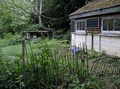
Woodland at Bredhurst - Sold Just over 1 acre | £15,000 Freehold
A small area of oak and chestnut woodland within the larger Bredhust woodlands. Designated as semi-narual ancient woodland and is located in the Kent Downs AONB (area of oustanding natural…
Davis Wood - Sold About 5¼ acres | £65,000 Freehold
Packed with good straight oak any owner would find this wood a delight, there is promise here for a fine crop when the trees are finally mature. In winter it's…
Mount Wood, Rusper, West Sussex - Sold Almost 12 acres | £112,000 Freehold
Typical picturesque Sussex High Weald woodland with long road frontage to a quiet country lane. The woodland structure consists of a scattering of older, larger oaks with a younger component…
Furzeland Copse - Sold About 9 acres | £120,000 Freehold
Description Mixed woodland set in strikingly beautiful hilly and wooded scenery, where streams flow through the entire length. One stream forms the southern boundary, the other flows in a small…
Teise Wood, near Frant, Tunbridge Wells - Sold About 5 acres | £60,000 Freehold
So much to enjoy, Teise Wood slopes gently down to the river Teise which forms its northern boundary on the far bank. The Teise here runs swiftly and eventually joins…
Longbow Wood - Sold About 5½ acres | £55,000 Freehold
In some of Longbow Wood, magnificent Corsican pine provide lofty shade under a high canopy. Much of the wood, however, has young oaks, chestnut, birch and maple. Under these there…
Windmill Hill Wood - Sold About 4⅓ acres | £55,000 Freehold
Windmill Hill, the high point of Wrotham Heath has a rather pretty woodland tucked away off Windmill hill Lane. Scots pine are well spread out and make the tallest trees,…
Cottage Wood, Charing, Kent - Sold About 7 acres | £77,000 Freehold
Considered as ancient replanted woodland it is mostly sweet chestnut coppice with a spread of mature oak, ash and silver birch. Beech is found on the boundary. Beautiful bluebells in…
East Mount woodland - Sold About 3⅔ acres | £34,000 Freehold
Woodland in the London suburbs of Surrey. East Mount woodland, located at the end of The Mount has mature ash and sycamore running alongside the bridleway and along the eastern…
Glovers Wood - part - Sold In all about 3 acres | £40,000 Freehold
A delightful bluebell woodland, with high conservation value and classified as a priority woodland habitat, close to the neighbouring SSSI, (site of special scientific interest) it has the advantages without…
New Frith Wood - Sold About 15½ acres | £150,000 Freehold
Ancient and semi-natural woodland, New Frith Wood has the woodland flowers and trees to support this designation. Mostly level it is served by two boundary tracks and two internal tracks. …
Lyde Wood, near Basingstoke - Sold About 5½ acres | £75,000 Freehold
Lyde Wood with almost 200 metres of river frontage on the upper reaches of the river Lyde is a wildlife gem. Polaroid glasses will greatly help with seeing any fish…
Briar Wood, near Hothfield, Kent - Sold About 7 acres | £74,500 Freehold
Description Across the stream, which flows through Briar Wood, there are two breached dams and retaining banks, which historically certainly formed ponds within the wood. Although some substantial trees now…
Lower Chalybeate Wood - Sold About 4¼ acres | £45,000 Freehold
Description Lower Chalybeate Wood is set on the gentle west facing slope of a small valley, between two woodland tracks. Part of the larger SSSI semi-natural ancient Combwell Wood as…
Wartling Wood, Hailsham, East Sussex - Sold About 16⅓ acres | £160,000 Freehold
Ancient and semi-natural woodland just by Herstmonceaux Castle and Observatory, the home of Britsh astronomy. This area for sale is part of the whole Wartling Wood. Much of…
Whistle Wood - Sold About 7¾ acres | £59,000 Freehold
A lovely family woodland. Beyond the stately pines lies a hidden valley with mainly birch, and a small stream running through it from west to east. There are several natural…
Hogshead Wood, near Sissinghurst, Kent - Sold About 8¼ acres | £68,000 Freehold
Description Hogshead Wood is set in a valley, with a small seasonal stream in the lower part. The wood contains a good mix of trees, dominated by some large areas…
Marks Wood - Sold About 4 acres | £28,000 Leasehold
The Surrey Hills supports large areas of woodland and forest, Marks Wood is set centrally well away from roads at the end of a long private track where there is…
Easter Wood - Sold About 8⅓ acres | £80,000 Freehold
Description Although Easter Wood is mainly a traditional Kentish chestnut coppice, there are a great variety of other species here, such as hornbeam, oak, ash, hazel, Corsican pine, and larch.…
Deacon Wood - Sold Over 8½ acres | £69,000 Freehold
Description This woodland offers variety as well as privacy. The main part of the woodland is traditional Kentish chestnut coppice, interspersed with some fine oaks. There is a useful clearing…
Lake Wood - Sold About ¾ acre in all | £30,000 Freehold
Tucked away in deepest Kent countryside here is a large pond, ideal for peaceful comtemplation either fishing (it will need stocking and cleaning) or private camping, perfect for a family…
Priory Wood - Sold About 4 acres | £39,000 Freehold
Priory Wood, just by the remains of the old Priory, has plenty of firewood, ponds suitable for enlargement and surprisingly despite its proximity to the M3 a wealth of wildlife. …
Fangorn Wood - Sold About 9½ acres | £110,000 Freehold
This most quiet, attractive and very private wood is set in a semi-natural ancient woodland area known as Combwell Woods. It has many interesting features and is surrounded by other…
Long Cutts Wood - Sold 6⅓ acres | £100,000 Freehold
Fine Surrey woodland with mature oaks and chestnut, evenly spaced over open ground. Although well-spaced the canopy is closed and walking or strolling around the wood is an easy exercise. …
Fox Brush Wood - Sold About 4⅓ acres | £40,000 Freehold
Description Well away from the road up a private track Fox Brush Wood is secluded and provides the woodland owner with native woodland habitat and its associated wildlife. The wood…
Can't find the right woodland for you?
- Subscribe to email updates to find out when we have new woodlands in this region.
- Find more woods for sale in South East England on Woodands.co.uk.